39 Visitors Tracking The Tropics!

SUPPORT TRACK THE TROPICS
Over the last decade plus if you appreciate the information and tracking I provide during the season along with this website which donations help keep it running please consider a one time... recurring or yearly donation if you are able to help me out...
Venmo: @TrackTheTropicsLouisiana
Website: TrackTheTropics.com/DONATE

DONATE


Track The Tropics has been the #1 source to track the tropics 24/7 since 2013! The main goal of the site is to bring all of the important links and graphics to ONE PLACE so you can keep up to date on any threats to land during the Atlantic Hurricane Season! Hurricane Season 2024 in the Atlantic starts on June 1st and ends on November 30th. Do you love Spaghetti Models? Well you've come to the right place!! Remember when you're preparing for a storm: Run from the water; hide from the wind!

Saffir-Simpson Hurricane Scale
Category Wind Speed Storm Surge
  mph ft
5 ≥157 >18
4 130–156 13–18
3 111–129 9–12
2 96–110 6–8
1 74–95 4–5
Additional Classifications
Tropical Storm 39–73 0–3
Tropical Depression 0–38 0
The Saffir-Simpson Hurricane Scale is a classification used for most Western Hemisphere tropical cyclones that exceed the intensities of "tropical depressions" and "tropical storms", and thereby become hurricanes. Source: Intellicast

Hurricane Season 101

The official Atlantic Basin Hurricane Season runs from June 1st to November 30th.

A tropical cyclone is a warm-core, low pressure system without any “front” attached. It develops over tropical or subtropical waters, and has an organized circulation. Depending upon location, tropical cyclones have different names around the world. The Tropical Cyclones we track in the Atlantic basin are called Tropical Depressions, Tropical Storms and Hurricanes!

Atlantic Basin Tropical Cyclones are classified as follows:

Tropical Depression: Organized system of clouds and thunderstorms with defined surface circulation and max sustained winds of 38 mph or less.

Tropical Storm: Organized system of strong thunderstorms with a defined surface circulation and maximum sustained winds of 39-73 mph.

Hurricane: Intense tropical weather system of strong thunderstorms with a well-defined surface circulation. A Hurricane has max sustained winds of 74 mph or higher!

The difference between Tropical Storm and Hurricane Watches, Warnings, Advisories and Outlooks

Warnings:Listen closely to instructions from local officials on TV, radio, cell phones or other computers for instructions from local officials.Evacuate immediately if told to do so.

  • Storm Surge Warning: There is a danger of life-threatening inundation from rising water moving inland from the shoreline somewhere within the specified area. This is generally within 36 hours. If you are under a storm surge warning, check for evacuation orders from your local officials.
  • Hurricane Warning: Hurricane conditions (sustained winds of 74 mph or greater) are expected somewhere within the specified area. NHC issues a hurricane warning 36 hours in advance of tropical storm-force winds to give you time to complete your preparations. All preparations should be complete. Evacuate immediately if so ordered.
  • Tropical Storm Warning: Tropical storm conditions (sustained winds of 39 to 73 mph) are expected within your area within 36 hours.
  • Extreme Wind Warning: Extreme sustained winds of a major hurricane (115 mph or greater), usually associated with the eyewall, are expected to begin within an hour. Take immediate shelter in the interior portion of a well-built structure.

Please note that hurricane and tropical storm watches and warnings for winds on land as well as storm surge watches and warnings can be issued for storms that the NWS believes will become tropical cyclones but have not yet attained all of the characteristics of a tropical cyclone (i.e., a closed low-level circulation, sustained thunderstorm activity, etc.). In these cases, the forecast conditions on land warrant alerting the public. These storms are referred to as “potential tropical cyclones” by the NWS.
Hurricane, tropical storm, and storm surge watches and warnings can also be issued for storms that have lost some or all of their tropical cyclone characteristics, but continue to produce dangerous conditions. These storms are called “post-tropical cyclones” by the NWS.

Watches: Listen closely to instructions from local officials on TV, radio, cell phones or other computers for instructions from local officials. Evacuate if told to do so.

  • Storm Surge Watch: Storm here is a possibility of life-threatening inundation from rising water moving inland from the shoreline somewhere within the specified area, generally within 48 hours. If you are under a storm surge watch, check for evacuation orders from your local officials.
  • Hurricane Watch: Huriricane conditions (sustained winds of 74 mph or greater) are possible within your area. Because it may not be safe to prepare for a hurricane once winds reach tropical storm force, The NHC issues hurricane watches 48 hours before it anticipates tropical storm-force winds.
  • Tropical Storm Watch: Tropical storm conditions (sustained winds of 39 to 73 mph) are possible within the specified area within 48 hours.

Advisories:

  • Tropical Cyclone Public Advisory:The Tropical Cyclone Public Advisory contains a list of all current coastal watches and warnings associated with an ongoing or potential tropical cyclone, a post-tropical cyclone, or a subtropical cyclone. It also provides the cyclone position, maximum sustained winds, current motion, and a description of the hazards associated with the storm.
  • Tropical Cyclone Track Forecast Cone:This graphic shows areas under tropical storm and hurricane watches and warnings, the current position of the center of the storm, and its predicted track. Forecast uncertainty is conveyed on the graphic by a “cone” (white and stippled areas) drawn such that the center of the storm will remain within the cone about 60 to 70 percent of the time. Remember, the effects of a tropical cyclone can span hundreds of miles. Areas well outside of the cone often experience hazards such as tornadoes or inland flooding from heavy rain.

Outlooks:

  • Tropical Weather Outlook:The Tropical Weather Outlook is a discussion of significant areas of disturbed weather and their potential for development during the next 5 days. The Outlook includes a categorical forecast of the probability of tropical cyclone formation during the first 48 hours and during the entire 5-day forecast period. You can also find graphical versions of the 2-day and 5-day Outlook here

Be sure to read up on tons of more information on Hurricane knowledge, preparedness, statistics and history under the menu on the left hand side of the page!

TrackTheTropics Resource Links

CONUS Hurricane Strikes

1950-2017
[Map of 1950-2017 CONUS Hurricane Strikes]
Total Hurricane Strikes 1900-2010 Total Hurricane Strikes 1900-2010 Total MAJOR Hurricane Strikes 1900-2010 Total Major Hurricane Strikes 1900-2010 Western Gulf Hurricane Strikes Western Gulf Hurricane Strikes Western Gulf MAJOR Hurricane Strikes Western Gulf Major Hurricane Strikes Eastern Gulf Hurricane Strikes Eastern Gulf Hurricane Strikes Eastern Gulf MAJOR Hurricane Strikes Eastern Gulf Major Hurricane Strikes SE Coast Hurricane Strikes SE Coast Hurricane Strikes SE Coast MAJOR Hurricane Strikes SE Coast Major Hurricane Strikes NE Coast Hurricane Strikes NE Coast Hurricane Strikes NE Coast MAJOR Hurricane Strikes NE Coast Major Hurricane Strikes

2016 Hurricane Season Outlook from Louisiana Hurricane Center
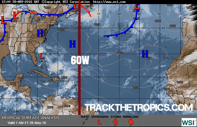
60W Hurricane Season Outlook

Today June 1st marks the “OFFICIAL” start of the 2016 Hurricane Season and we already have had named 2 storms! Hurricane Alex formed in January and Tropical Storm Bonnie just made landfall recently in South Carolina.

Louisiana Hurricane Center’s Thoughts on this season With all of the data and forecasts I have gone over the […]

Tropical Storm Ana 2015 Archive

Tropical Storm Ana historical Information: On May 3, the National Hurricane Center began highlighting the expected formation of a non-tropical area of low pressure north of the Bahamas. Early on May 6, a weak surface low was associated with a broad upper trough as disorganized shower and thunderstorm activity extended across Florida, The Bahamas, […]

Early start to the 2015 Hurricane Season?

Good afternoon… hope everyone is having a great weekend! We are now less than a month away from the official start of the 2015 Hurricane Season and it seems their is a chance we might get started a little early. All major models are showing a possible weak area of low pressure forming just […]

Hurricane Season 2014 Review – The Below Average Season Is OVER!

November 30th was the official end of the 2014 Hurricane Season!! This season as predicted by most was a very slow below average season marking another year without a major hurricane hitting the United States. It has now been a record breaking nine years since a major Hurricane (Cat 3 or higher) has hit […]

5 New Pages Added To The Site: Wind Shear, SSTs, SAL, MJO and Precip Forecasts!

***Website Update – 5 New Pages Added*** Although you can find many of these maps/images on the main page of TrackTheTropics.com I went ahead and added dedicated pages for more detailed information and larger images on Wind Shear, SSTs, SAL, MJO Forecasts and Precip Forecasts. The 5 new page additions are listed below…

Atlantic Wind […]

New Website Feature: Hurricane Hunters Live Recon In The Atlantic Basin

***New Website Feature*** Track The NOAA Hurricane Hunters Live on my site whenever they have a Recon Mission! Here is the direct link: https://trackthetropics.com/hurricane-hunters-live-recon-atlantic-basin/ you can always access this page thru the Menu on the left sidebar.

Also at the bottom of the page is their Schedule and Plan of the Day. Its updated daily […]

New Website Feature: Real Time Buoy and Oil Rig Data…

***New Website Feature*** Hey y’all just added a new section to the website… an interactive real time map of current Buoy and Oil Rig readings from across the globe! Also below the map is an output of all the Buoy/Rig data within 700 nautical miles of New Orleans, Louisiana. This will be yet another great […]

Still Watching For Possible Tropical Development In Gulf Between June 5th and June 10th…

***MODEL WATCH*** Good afternoon y’all!! For the past couple weeks I have been talking about a possible storm in the Gulf at the beginning of June to start the 2014 Hurricane Season and models still continue to show this possibility…

Here is the latest GFS that just ran today 5-30-14 12Z showing a possible […]

Continuing to Monitor The NW Carribbean For Possible Development…

***MODEL WATCH 5-26-14*** The GFS, FIM and CMC today continue to show development coming out of the Caribbean somewhere between June 2nd – 6th timeframe. The CMC today is the most aggressive showing a possible Tropical Storm in the Gulf June 3rd an…d the GFS just showing a disturbance/depression at most. Right now with models […]