
 There is an old saying "An ounce of prevention is a pound of cure.". This is never more true than when it come to tropical cyclones and the damage they can cause. With some simple fore thought and planning, you can greatly reduce the risk of loss of your loved ones and important documents. The following are ways you can help protect your past, present, future, and peace of mind. This is your call to action!
Protecting Your Past
 After loved ones, people most regret loosing valuables (such as jewelry), items from the families past (such as photos and mementos), and important papers to natural disasters. While most of the appliances and furniture can be replaced, it is the treasured keepsakes and important documentation most regret loosing. These items include but are not limited to...
- Family Records (Birth, Marriage, Death Certificates),
- Inventory of Household goods,
- Copy of Will, Insurance policies, contracts, deeds, etc.,
- Record of credit card account numbers and companies,
- Passports, Social Security Cards, immunization records, and
- Valuable computer information.
Depending upon your particular tropical cyclone hazard(s), you have several options you can due to minimize the risk of loosing these items.
- Storm Surge
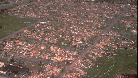
- Storm surges undermine building foundations by constant agitation of the water piled high by the tropical cyclone. The end result can be a complete demolishing of homes and businesses. If the storm is bad enough you will be asked evacuate and head inland to safety.In this case, you need to plan ahead for that possibility. For your valuables, have several large rubber storage containers available in which you place your photos and mementos so you can take them with you when you evacuate.
- Wind and Squalls
- Like the storm surge, hurricane force wind can destroy buildings. If a hurricane threatens your location your response should be the same as with the storm surge. Place your valuable in large rubber storage containers so you can take them with you should you need to evacuate.
- Inland Flooding
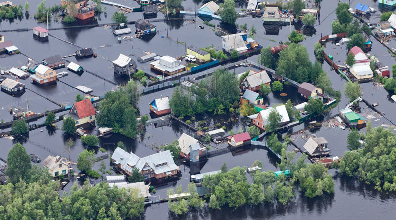 If you live well inland and storm surges and hurricane force winds will not be a problem, you could still be affected by flooding from very heavy rains. However, even in the most severe inland flood events, houses usually are not completely submerged. Simple precautionary steps now will help you save your memories.Begin with simply hanging pictures a little higher on the wall. This will help diminish the threat of loosing them forever to floods. Do you have extra photos laying around that may not be displayed? If they are not on display, place them in plastic storage containers and store them in the attic. Have an extra, empty plastic storage container available to quickly gather jewelry, mementos, and other displayed photos and place the container in the atticshould a flood emergency arrive.
If a flooding is occurring at your home, immediately shut off your electricity at the circuit breakers. This will prevent short circuiting electrical appliance such as refrigerators. In many cases, with minor flooding, the refrigerator will just need to be cleaned and can be put back into use again. If the power was left on in a flood, the short circuit will make repairs very costly. Also, if you normally keep valuable documents in a fire-proof safe, check to insure it is water-proof as well. Awater-resistant safe might not prevent water from entering the safe should it become submerged in a flood.
Protecting Your Present
Help protect your present dwelling by retrofitting your home. The most important precaution you can take to reduce damage to your home and property is to protect the areas where wind can enter. According to recent wind technology research, it's important to strengthen the exterior of your house so wind and debris do not tear large openings in it. You can do this by protecting and reinforcing these four critical areas:- The windows and doors,
- The roof and walls, and
- The garage door(s).
A great time to start securing, or retrofitting, your house is when you are making other improvements or constructing additions. Remember: building codes reflect the lessons experts have learned from past catastrophes. Contact the local building code official to find out what requirements are necessary for your home improvement projects.
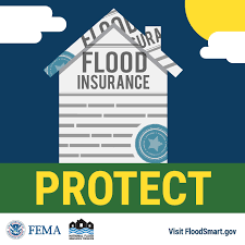
Help protect your present dwelling through flood insurance.
When you hear hurricane, think flooding, both from storm surge and from inland flooding. Learn your vulnerability to flooding by determining the elevation of your property. Evaluate your insurance coverage; as construction grows around areas, floodplains change.
Why flood insurance? Because damage from floods are not usually covered by homeowners policies. Flood insurance is affordable. The average flood insurance policy costs a little more than $300 a year for about $100,000 of coverage. In comparison, a disaster home loan can cost you more than $300 a month for $50,000 over 20 years.
You should know that usually you can get flood insurance, if available, by contacting your regular homeowners insurance agent. The Federal Emergency Management Agency (FEMA) and others recommend that everyone in special flood hazard areas buy flood insurance. If you buy a home or refinance your home your mortgage lender or banker may require flood insurance. But, even if not required, it is a good investment especially in areas that flood frequently or where flood forces are likely to cause major damage.
 If you are in a flood area, consider what mitigation measure you can do in advance. For example, in highly flood-prone areas, keep materials on hand like sandbags, plywood, plastic sheeting, plastic garbage bags, lumber, shovels, work boots and gloves. Call your local emergency management agency to learn how to construct proper protective measures around your home.
There is usually a 30-day waiting period before the coverage goes into effect. Plan ahead so you're not caught without flood insurance when a flood from tropical cyclones threatens your home or business. Remember, federal disaster assistance is not the answer. Federal disaster assistance is only available if the President declares a disaster. More than 90 percent of all disasters in the United States are not Presidentially declared. Flood insurance pays even if a disaster is not declared.
National Flood Insurance Program call 1.888.379.9531, TTY# 1.800.427.5593.
Protecting Your Future
The previous "Calls To Action" were concerned mainly about your property. The following steps are primarily for your protection and to help ensure the safety of your loved ones.Your best protection is to know when there is a threat of hazardous weather. Before the start of the tropical cyclone season, obtain a NOAA Weather Radio and listen to the forecast directly from your local National Weather Service Office. Not only will to be better informed concerning tropical weather systems, you will be able to be alerted to all types of hazardous weather that could affect you.
At the start of the tropical cyclone season...
- Monitor your NOAA Weather Radio for tropical weather updates and visit the NWS Southern Region's Tropical Weather Update.
- Review your evacuation routes. Contact the local emergency management office or American Red Cross chapter, and ask for the community hurricane preparedness plan. This plan should include information on the safest evacuation routes and nearby shelters. These routes may change from year to year depending upon local construction.
- Make a disaster supply kit that includes...
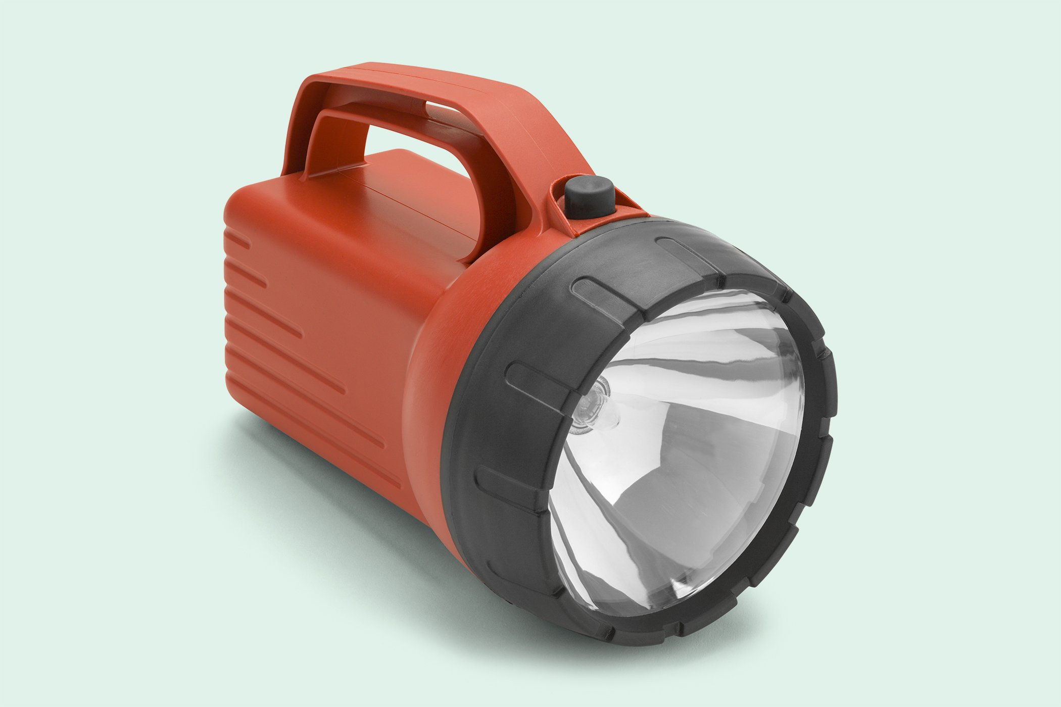 At least two waterproof flashlights with extra, fresh batteries,
- Portable, battery-operated NOAA Weather Radio and AM/FM radio with extra, fresh batteries,
- Either purchase an approved American Red Cross First Aid Kit or put your own together. Include...
- Assorted sizes of sterile adhesive bandages, sterile gauze pads, and roller bandages,
- Hypoallergenic adhesive tape and triangular bandages,
- Scissors, tweezers, needle and thread, and assorted sizes of safety pins,
- Medicine dropper and thermometer,
- Safety razor and blades,
- Bar of soap, moistened towelettes packages and antiseptic spray,
- Tongue blades and wooden applicator sticks,
- Tube of petroleum jelly or other lubricant,
- Cleansing agent, and
- latex gloves.
- Disposable camera with flash,
- Emergency food and eating supplies...
- Non-perishable packaged or canned foods and juices (check the expiration dates),
- Special foods for infants or the elderly (check the expiration dates),
- Cooking tools and fuel,
- Paper plates and plastic utensils, and
- A non-electric can opener.
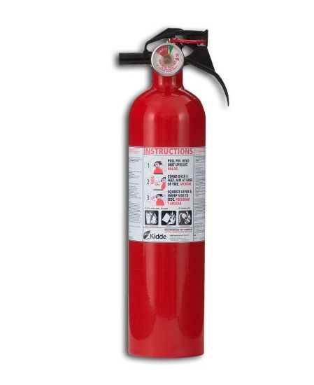 Fire Extinguisher - Class ABC extinguishes can be safely used on any type of fire, including electrical, grease or gas.
- Plan to take care of your pets. Contact your local humane society for information on local animal shelters as pets may not be allowed into emergency shelters for health and space reasons. Also, store two weeks of pet supplies.
- Teach children how and when to call 9-1-1, police, or fire department and which radio station to tune to for emergency information.
- Prepare your protection for your windows. If you wait until a hurricane watch is in effect, plywood may be in short supply. Use ½" plywood (marine plywood is best) cut to fit each window. Remember to mark which board fits which window. Read more about window protection.
- Trim trees and remove dead or weak branches.
- Develop an emergency communication plan. In case family members are separated from one another during a disaster (a real possibility during the day when adults are at work and children are at school), have a plan for getting back together. Ask an out-of-state relative or friend to serve as the "family contact." After a disaster, it's often easier to call long distance. Make sure everyone in the family knows the name, address, and phone number of the contact person.
- Check to ensure tie-downs are secured properly if you live in a mobile home.
At the end of the tropical cyclone season, use the food you stored provided the you have not exceeded the expiration dates. You will want to store fresh supplies for the next tropical cyclone season.
If a hurricane watch is issued for your area, you could experience hurricane force wind conditions within 48 hours. Do the following...
- Listen to the NOAA Weather Radio for hurricane progress report,
- Check your disaster supply kit to ensure it is up to date,
- Fuel your automobile. Be ready to drive 20 to 50 miles inland to locate a safe place,
- Bring in outdoor objects such as lawn furniture, toys, and garden tools,
- Anchor outside objects that cannot be brought inside,
- Secure buildings by closing and boarding up windows,
- Remove outside antennas,
- Turn refrigerator and freezer to coldest settings. Open only when absolutely necessary and close quickly. Freeze as much water as you can. This will help keep your refrigerator cold if the power is out for several days,
- Store drinking water in jugs and bottles. You will need at least 1 gallon daily per person for up to seven days,
- Moor boat securely or move it to a designated safe place. Use rope or chain to secure boat to trailer and use tie-downs to anchor trailer to the ground,
- Review evacuation plan,
- Collect essential medicines into one place so you can quickly grab them should you need to evacuate, and
- Get extra cash. With the possibility of no electricity, ATM's and credit card purchases will not work.
If a hurricane warning is issued for your area then sustained winds of at least 74 mph are expected within 36 hours or less. Do the following...
- Listen to the NOAA Weather Radio for hurricane progress reports.
- Listen to the radio or television for official instructions.
- Avoid elevators should the electricity fail.
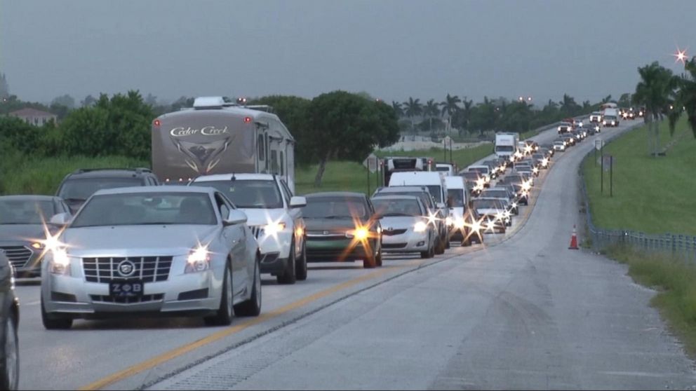
- If officials indicate evacuation is necessary you should do so immediately.
- Turn the water off at the main water valve.
- Turn off the gas at the outside main valve.
- Tell someone outside of the storm area where you are going.
- If time permits, and you live in an identified surge zone, elevate furniture to protect it from flooding or better yet, move it to a higher floor.
- Bring your pre-assembled emergency supplies, warm protective clothing, blankets, and sleeping bags to shelter.
- Lock up home and leave as soon as possible. Avoid flooded roads and watch for washed-out bridges.
- If you choose to remain at your house...
- Stay in the interior portion of your house, away from windows, skylights, and glass doors.
- Keep several flashlights and extra batteries handy.
- If your house is damaged by the storm you should turn the water and gas off at the main valves.
- If power is lost, turn off electricity at the circuit breakers to reduce power "surge" when electricity is restored. Also avoid open flames, such as candles and kerosene lamps, as a source of light.
 Remember, if the hurricane is forecast to move directly over your location, you may be in the path of the eye wall. This means that at the height of the storm, you could experience a sudden, rapid decrease in storm intensity as the hurricane's eye passes over your location. Remain in your shelter as the back side of the storm can be only minutes away with a just as sudden and rapid increase in wind speed, this time from the opposite direction.
After the hurricane has completely passed your location do the following...
- Listen to the NOAA Weather Radio for hurricane progress reports.
- Stay tuned to local radio for information.
- Return home only after authorities advise that it is safe to do so.
- Once home, check refrigerated foods for spoilage.
- Take pictures of the damage, both to the house and its contents and for insurance claims.
If you remained at your house during the storm...
- Help injured or trapped persons. Give first aid where appropriate. Do not move seriously injured persons unless they are in immediate danger of further injury. Call for help.
- Avoid loose or dangling power lines and report them immediately to the power company, police, or fire department. Be careful and not step onto objects in contact with downed power lines.
- Beware of snakes, insects, and animals driven to higher ground by flood water.
- If your home has been damaged, open windows and doors to ventilate and dry your home.
- Take pictures of the damage, both to the house and its contents and for insurance claims.
- Drive only if absolutely necessary and avoid flooded roads and washed-out bridges.
- Use telephone only for emergency calls.
- Check for gas leaks. If you smell gas or hear blowing or hissing noise, open a window and quickly leave the building. Turn off the gas at the outside main valve if you can and call the gas company from a neighbor's home. If you turn off the gas for any reason, it must be turned back on by a professional.
- Look for electrical system damage. If you see sparks or broken or frayed wires, or if you smell hot insulation, turn off the electricity at the main fuse box or circuit breaker. If you have to step in water to get to the fuse box or circuit breaker, call an electrician first for advice.
- Check for sewage and water lines damage. If you suspect sewage lines are damaged avoid using the toilets and call a plumber. If water pipes are damaged, contact the water company and avoid the water from the tap. You can obtain safe water by melting ice cubes.
Protecting your Peace of Mind
Tropical cyclones, in and of themselves, are not "bad" things. They are just one way nature transfers heat energy from the tropics to the north and south poles. What makes them bad to us is when they affect us. While these storms cannot be prevented you can have peace of mind knowing you did all you could to minimize the impact on your life. If you are moving into an area that can be affect by tropical storms, try to avoid living in a place where you may be at risk of storm surge. Also, creeks and rivers, while picturesque, could become disasters areas during a flood; stick to higher ground. Anything to can do to minimize the future impact of a tropical cyclone on your home will be one less thing to worry about if the event occurs.
Remember, past experiences of tropical cyclones are NO measure of future events. There may, and probably will be times, when you return to your home, after evacuating, to find no damage whatsoever as the storm either weakened or turned away from where we thought it would strike. However, the time you spent preparing your home and loved ones was NOT wasted because the next time you may not be so fortunate.
You may hear some of the "locals" make statements like "I've lived here x-number of years made it through storms such-and-such" or "a certain hill or creek protected us at this-or-that place". While you cannot discount their experiences, you can know they were fortunate during those events. It's best to be prepared. This could be the year a tropical cyclone could bring devastating results.
 For your peace of mind, always heed your local officials instructions. It is their responsibility to serve your community. If you follow their guiding, you will make their job much easier. If they ask you to evacuate, do so immediately. This way, you will not be a burden on the local rescue teams so they can better assist the ones who may need rescue through no fault of their own.
Your evacuation will also aid the police after the storm passes. Unfortunately, some people try to take advantage of others going through difficult situations. While generally not widespread, looting does occur in neighborhoods damaged by tropical storms. Your absence will help the police better monitor the region and make it easier to spot the ones who do not belong.
One final word of caution. You may live thousands of miles from the effects of tropical cyclone and think you can not be a victim. However, that is not always the case. Vehicles that have been flooded are suppose to be relegated for salvage but many are not. The unscrupulous do superficial cleaning jobs on the vehicles and wholesale them to dealers across the nation. If you are considering purchasing a used vehicle, be sure to check the title history and hire a trusted mechanic to do a thorough inspection including checking behind the door panel for signs of flooding. A few dollars spent now could save your thousands of dollars down the road and maybe a life.