NHC Important Links: NHC Discussion / Public Advisory / Forecast Advisory / Wind Probs / NWS Local Products / US Watch/Warning / Graphics / Storm Archive
Important LOCAL Links: NWS Boston, MA / NWS New York City, NY / NWS Winds/Gusts/Waves Map / Current Power Outages / SPC Watches and Warnings
Storm Tracking Important Links: Wind Analysis / Coastal Inundation Info / Tide Information / Surge Map / Surge Potential / Coastal Risk Map / Microwave Imagery / Advanced Dvorak ADT / GOES16 Satellite Storm Page / FSU Track Probability / NOAA Tracker / Albany Tracker / Navy NRL Page / HFIP Products / Tropical Atlantic Storm Page / NCAR Guidance Page / CyclonicWX Tracker / CIMSS Tracker / Tropical Tidbits Storm Page /UWM Tracker / SFWMD Models
Peak Storm Surge Forecast

Potential Storm Surge Flooding Map (Inundation)
Additional Potential Storm Surge Map
Flash Flood Risk

Rainfall Forecast

5 Day WPC Rainfall Forecast
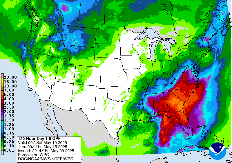
24 hour - 7 Day

Potential Storm Surge Flooding Map (Inundation)
Additional Potential Storm Surge Map
Flash Flood Risk

Rainfall Forecast

5 Day WPC Rainfall Forecast

24 hour - 7 Day
WeatherNerds.org Floaters
Other Floater Sites:
TropicalTidbits - NRL Floaters - CyclonicWx - RAMMB Sat - RAMMB Model Data - RAMMB Wind Products

|

|

|

|
TropicalTidbits - NRL Floaters - CyclonicWx - RAMMB Sat - RAMMB Model Data - RAMMB Wind Products
- Sun, 10 Nov 2024 20:32:06 +0000: Atlantic Post-Tropical Cyclone Rafael Advisory Number 30 - Atlantic Post-Tropical Cyclone Rafael Advisory Number 30
000
WTNT33 KNHC 102032
TCPAT3
BULLETIN
Post-Tropical Cyclone Rafael Advisory Number 30
NWS National Hurricane Center Miami FL AL182024
300 PM CST Sun Nov 10 2024
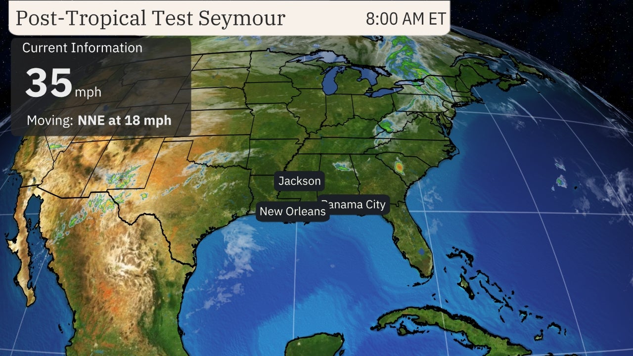
...RAFAEL DEGENERATES TO A POST-TROPICAL REMNANT LOW...
...THIS IS THE FINAL NHC ADVISORY...
SUMMARY OF 300 PM CST...2100 UTC...INFORMATION
----------------------------------------------
LOCATION...26.1N 91.3W
ABOUT 345 MI...560 KM NNW OF PROGRESO MEXICO
MAXIMUM SUSTAINED WINDS...35 MPH...55 KM/H
PRESENT MOVEMENT...E OR 90 DEGREES AT 3 MPH...6 KM/H
MINIMUM CENTRAL PRESSURE...1006 MB...29.71 INCHES
WATCHES AND WARNINGS
--------------------
There are no coastal watches or warnings in effect.
DISCUSSION AND OUTLOOK
----------------------
At 300 PM CST (2100 UTC), the center of Post-Tropical Cyclone Rafael
was located near latitude 26.1 North, longitude 91.3 West. The
post-tropical cyclone is moving toward the east near 3 mph (6 km/h).
The remnant low is expected to meander over the central Gulf of
Mexico through tonight, then turn toward the south and
south-southwest on Monday and Tuesday.
Maximum sustained winds have decreased to near 35 mph (55 km/h) with
higher gusts. The remnant low is forecast to dissipate by Tuesday
night.
The estimated minimum central pressure is 1006 mb (29.71 inches).
HAZARDS AFFECTING LAND
----------------------
Key messages can be found in the Tropical Cyclone Discussion under
AWIPS header MIATCDAT3 and WMO header WTNT43 KNHC and on the web at
hurricanes.gov/text/MIATCDAT3.shtml
SURF: Swells will continue impacting portions of the northern and
western Gulf Coast through Monday. These swells are likely to cause
life-threatening surf and rip current conditions. Please consult
products from your local weather office.
NEXT ADVISORY
-------------
This is the last public advisory issued by the National Hurricane
Center on Rafael. Additional information on this system can be found
in High Seas Forecasts issued by the National Weather Service, under
AWIPS header NFDHSFAT1, WMO header FZNT01 KWBC, and online at
ocean.weather.gov/shtml/NFDHSFAT1.php
$$
Forecaster Reinhart
- Sun, 10 Nov 2024 20:31:36 +0000: Atlantic Post-Tropical Cyclone RAFAEL Forecast/Adv... - Atlantic Post-Tropical Cyclone RAFAEL Forecast/Advisory Number 30 NWS NATIONAL Hurricane CENTER MIAMI FL AL182024 2100 UTC SUN NOV 10 2024 POST-TROPICAL Cyclone CENTER LOCATED NEAR 26.1N 91.3W AT 10/2100Z POSITION ACCURATE WITHIN 30 NM PRESENT MOVEMENT TOWARD THE EAST OR 90 DEGREES AT 3 KT ESTIMATED MINIMUM CENTRAL PRESSURE 1006 MB MAX SUSTAINED WINDS 30 KT WITH GUSTS TO 40 KT. 12 FT SEAS.. 75NE 0SE 0SW 0NW. WINDS AND SEAS VARY GREATLY IN EACH QUADRANT. RADII IN NAUTICAL MILES ARE THE LARGEST RADII EXPECTED ANYWHERE IN THAT QUADRANT. REPEAT...CENTER LOCATED NEAR 26.1N 91.3W AT 10/2100Z AT 10/1800Z CENTER WAS LOCATED NEAR 26.2N 91.5W FORECAST VALID 11/0600Z 25.8N 90.9W...POST-TROP/REMNT LOW MAX WIND 25 KT...GUSTS 35 KT. FORECAST VALID 11/1800Z 25.1N 90.7W...POST-TROP/REMNT LOW MAX WIND 25 KT...GUSTS 35 KT. FORECAST VALID 12/0600Z 24.1N 91.0W...POST-TROP/REMNT LOW MAX WIND 20 KT...GUSTS 30 KT. FORECAST VALID 12/1800Z 23.2N 92.0W...POST-TROP/REMNT LOW MAX WIND 20 KT...GUSTS 30 KT. FORECAST VALID 13/0600Z...DISSIPATED REQUEST FOR 3 HOURLY SHIP REPORTS WITHIN 300 MILES OF 26.1N 91.3W THIS IS THE LAST FORECAST/Advisory ISSUED BY THE NATIONAL HURRICANE CENTER ON RAFAEL. ADDITIONAL INFORMATION ON THIS SYSTEM CAN BE FOUND IN HIGH SEAS FORECASTS ISSUED BY THE NATIONAL WEATHER SERVICE...UNDER AWIPS HEADER NFDHSFAT1 AND WMO HEADER FZNT01 KWBC. $$ FORECASTER REINHART
000
WTNT23 KNHC 102031
TCMAT3
POST-TROPICAL CYCLONE RAFAEL FORECAST/ADVISORY NUMBER 30
NWS NATIONAL HURRICANE CENTER MIAMI FL AL182024
2100 UTC SUN NOV 10 2024
POST-TROPICAL CYCLONE CENTER LOCATED NEAR 26.1N 91.3W AT 10/2100Z
POSITION ACCURATE WITHIN 30 NM
PRESENT MOVEMENT TOWARD THE EAST OR 90 DEGREES AT 3 KT
ESTIMATED MINIMUM CENTRAL PRESSURE 1006 MB
MAX SUSTAINED WINDS 30 KT WITH GUSTS TO 40 KT.
12 FT SEAS.. 75NE 0SE 0SW 0NW.
WINDS AND SEAS VARY GREATLY IN EACH QUADRANT. RADII IN NAUTICAL
MILES ARE THE LARGEST RADII EXPECTED ANYWHERE IN THAT QUADRANT.
REPEAT...CENTER LOCATED NEAR 26.1N 91.3W AT 10/2100Z
AT 10/1800Z CENTER WAS LOCATED NEAR 26.2N 91.5W
FORECAST VALID 11/0600Z 25.8N 90.9W...POST-TROP/REMNT LOW
MAX WIND 25 KT...GUSTS 35 KT.
FORECAST VALID 11/1800Z 25.1N 90.7W...POST-TROP/REMNT LOW
MAX WIND 25 KT...GUSTS 35 KT.
FORECAST VALID 12/0600Z 24.1N 91.0W...POST-TROP/REMNT LOW
MAX WIND 20 KT...GUSTS 30 KT.
FORECAST VALID 12/1800Z 23.2N 92.0W...POST-TROP/REMNT LOW
MAX WIND 20 KT...GUSTS 30 KT.
FORECAST VALID 13/0600Z...DISSIPATED
REQUEST FOR 3 HOURLY SHIP REPORTS WITHIN 300 MILES OF 26.1N 91.3W
THIS IS THE LAST FORECAST/ADVISORY ISSUED BY THE NATIONAL HURRICANE
CENTER ON RAFAEL. ADDITIONAL INFORMATION ON THIS SYSTEM CAN BE FOUND
IN HIGH SEAS FORECASTS ISSUED BY THE NATIONAL WEATHER
SERVICE...UNDER AWIPS HEADER NFDHSFAT1 AND WMO HEADER FZNT01 KWBC.
$$
FORECASTER REINHART
- Sun, 10 Nov 2024 20:32:37 +0000: Atlantic Post-Tropical Cyclone Rafael Discussion Number 30 - Atlantic Post-Tropical Cyclone Rafael Discussion Number 30
000
WTNT43 KNHC 102032
TCDAT3
Post-Tropical Cyclone Rafael Discussion Number 30
NWS National Hurricane Center Miami FL AL182024
300 PM CST Sun Nov 10 2024
The limited convection that Rafael was producing in its eastern
semicircle has collapsed. Surface observations, visible satellite
images, and a 1530z ASCAT-C pass show the surface circulation has
become poorly defined and very elongated in the north-south
direction. Since Rafael does not possess a well-defined center or
organized convection, it no longer meets the definition of a
tropical cyclone. This will be the final NHC advisory on Rafael.
The remnant low is expected to drift eastward over the central Gulf
of Mexico tonight, then turn toward the south and southwest on
Monday and Tuesday. The forecast calls for dissipation by Tuesday
night, but this could occur even sooner if current trends continue.
The elevated rip current risk along the northern and western Gulf
Coast will likely continue into Monday. For more information, see
products from your local NWS forecast office.
Additional information can be found in High Seas Forecasts issued by
the National Weather Service, under AWIPS header NFDHSFAT1, WMO
header FZNT01 KWBC, and online at
ocean.weather.gov/shtml/NFDHSFAT1.php
Key Messages:
1. Swells are likely to cause life-threatening surf and rip current
conditions along portions of the Gulf Coast through Monday.
FORECAST POSITIONS AND MAX WINDS
INIT 10/2100Z 26.1N 91.3W 30 KT 35 MPH...POST-TROPICAL
12H 11/0600Z 25.8N 90.9W 25 KT 30 MPH...POST-TROP/REMNT LOW
24H 11/1800Z 25.1N 90.7W 25 KT 30 MPH...POST-TROP/REMNT LOW
36H 12/0600Z 24.1N 91.0W 20 KT 25 MPH...POST-TROP/REMNT LOW
48H 12/1800Z 23.2N 92.0W 20 KT 25 MPH...POST-TROP/REMNT LOW
60H 13/0600Z...DISSIPATED
$$
Forecaster Reinhart

 DONATE
![[Map of 1950-2017 CONUS Hurricane Strikes]](http://www.nhc.noaa.gov/climo/images/conus_strikes_sm.jpg)
