
Projected Path with Watches and Warnings

Additional Projected Path Swath


Most Likely Arrival Time of Tropical Storm Force Winds

Most Reasonable Arrival Time of Tropical Storm Force Winds

Hurricane Force Wind Probabilities

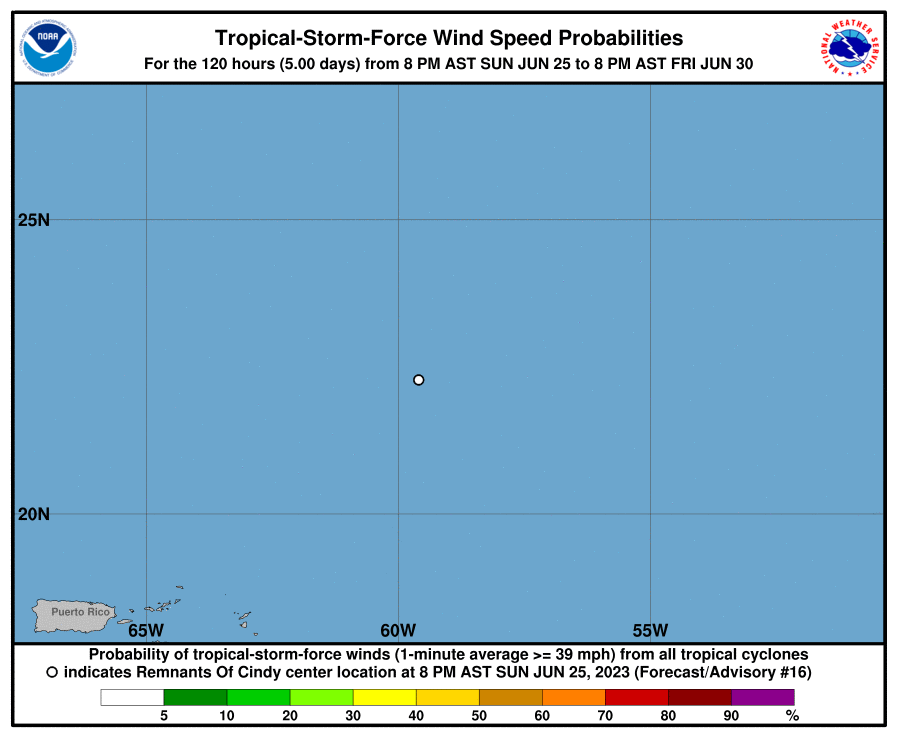
Tropical Storm Force Wind Probabilities
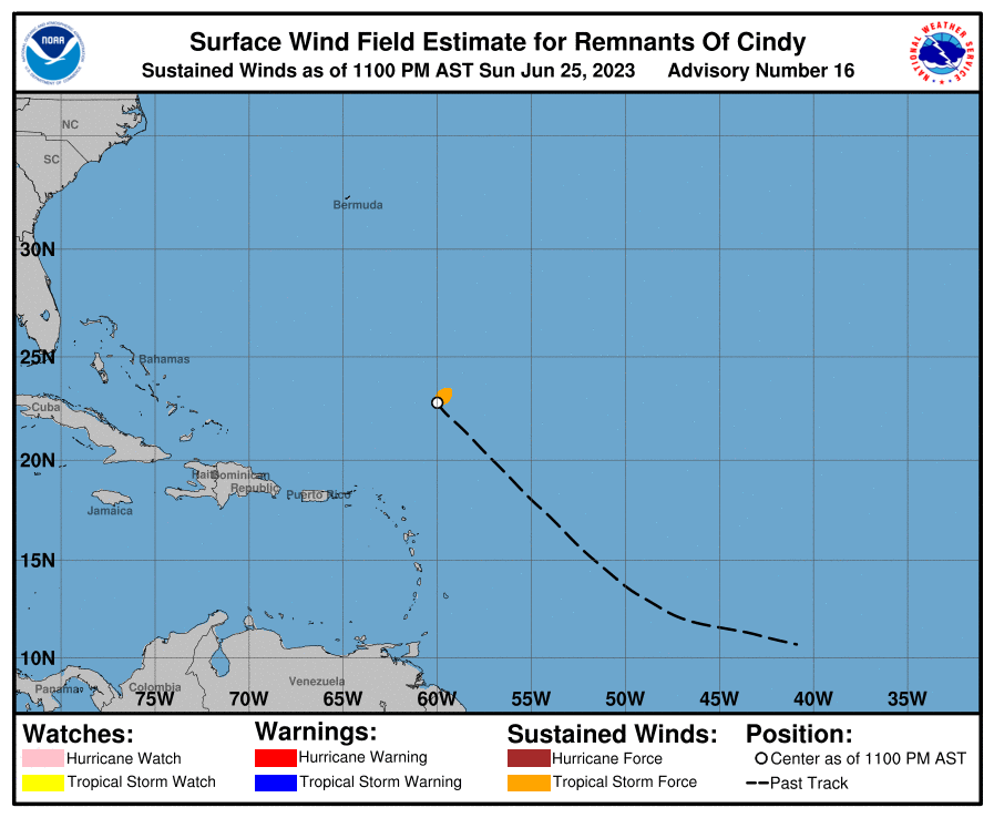
Surface Wind Field
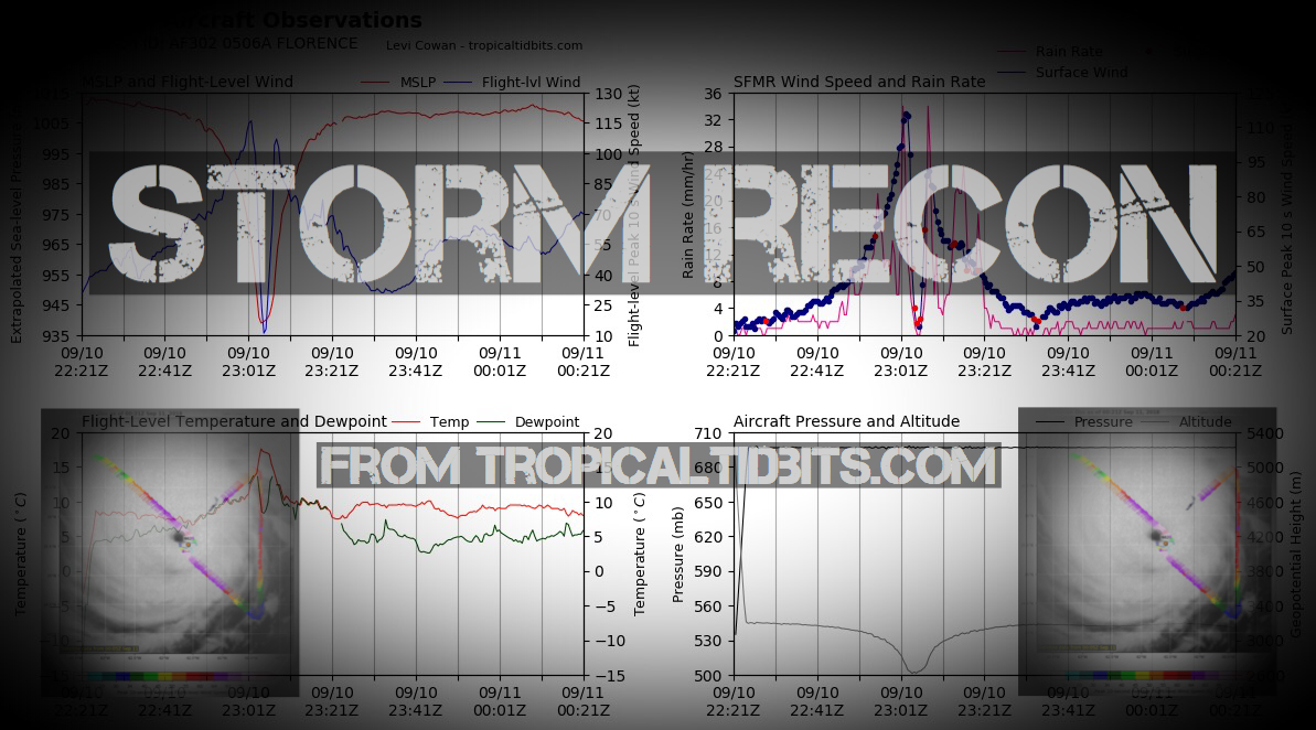
Cumulative Wind History

Windfield

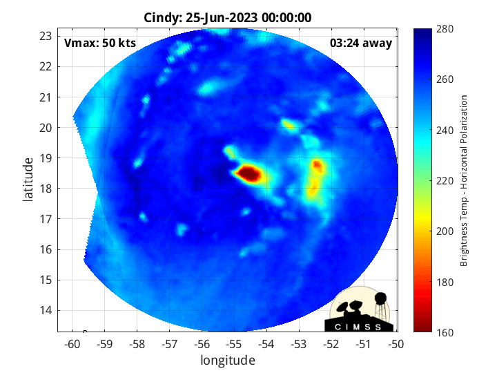
Microwave Imagery


Key Messages

WeatherNerds.org Floaters

|

|

|

|
Intensity Forecasts

Model Tracks


GFS / Canadian Ensemble Tracks

EURO Ensemble Tracks
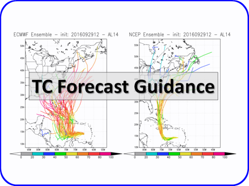
EPS Ensemble Tracks

2 Day Tropical Weather Outlook
7 Day Tropical Weather Outlook