
0 Active Threats To Track
SUPPORT TRACK THE TROPICS
Over the last decade plus if you appreciate the information and tracking I provide during the season along with this website which donations help keep it running please consider a one time... recurring or yearly donation if you are able to help me out...
Venmo: @TrackTheTropicsLouisiana
Website: TrackTheTropics.com/DONATE
Venmo: @TrackTheTropicsLouisiana
Website: TrackTheTropics.com/DONATE
Current Tropics Activity (hidden template)
U.S. THREAT | Active Storm |
ALERT | Active Storm |
ALERT | Active Invest 90L |
WATCHING | 1 Area Of Interest |
Track The Tropics is the #1 source to track the tropics 24/7! Since 2013 the main goal of the site is to bring all of the important links and graphics to ONE PLACE so you can keep up to date on any threats to land during the Atlantic Hurricane Season! Hurricane Season 2025 in the Atlantic starts on June 1st and ends on November 30th. Do you love Spaghetti Models? Well you've come to the right place!! Remember when you're preparing for a storm: Run from the water; hide from the wind!
Tropical Atlantic Weather Resources
- NOAA National Hurricane Center
- International Meteorology Database
- FSU Tropical Cyclone Track Probabilities
- Brian McNoldy Atlantic Headquarters
- Brian McNoldy Tropical Satellite Sectors
- Brian McNoldy Infrared Hovmoller
- Brian McNoldy Past TC Radar Loops
- Weather Nerds Models/ TC Guidance/ Sat
- Twister Data Model Guidance
- NOAA Tropical Cyclone Tracks
- Albany GFS/ EURO Models/ Ensembles
- Albany Tropical Cyclone Guidance
- Albany Tropical Atlantic Model Maps
- Pivotal Weather Model Guidance
- Weather Online Model Guidance
- UKMet Model Guidance/ Analysis/ Sat
- ECMWF (EURO) Model Guidance/ Analysis
- FSU Tropical Model Outputs
- FSU Tropical Cyclone Genesis
- Penn State Tropical E-Wall
- NOAA HFIP Ruc Models
- Navy NRL TC Page
- College of DuPage Model Guidance
- WXCharts Model Guidance
- NOAA NHC Analysis Tools
- NOAA NHC ATCF Directory
- NOAA NCEP/EMC Cyclogenesis Tracking
- NOAA NCEP/EMC HWRF Model
- NOAA HFIP Model Products
- University of Miami Ocean Heat Content
- COLA Max Potential Hurricane Intensity
- Colorado State RAMMB TC Tracking
- Colorado State RAMMB Tropical Floaters
- Colorado State RAMMB GOES-16 Viewer
- NOAA NESDIS GOES Satellite
- ASCAT Ocean Surface Winds METOP-A
- ASCAT Ocean Surface Winds METOP-B
- Michael Ventrice Waves / MJO Maps
- TropicalAtlantic.com Analysis / Recon
- NCAR/RAL Tropical Cyclone Guidance
- CyclonicWX Tropical Resources
Main Menu
- 2023 Atlantic Hurricane Season Main Page
- Official Atlantic Tracking Chart
- Support Track The Tropics!
- Tropical Weather Outlook
- Interactive Tracking Map
- Live Current and Future Winds
- Gulf / East Coast and Atlantic Satellite
- Africa / East Atlantic Satellite Loops
- Gulf of Mexico and East Coast Radar
- Current Tropical Surface Analysis Maps
- Future Tropical Surface Analysis Maps
- Sea Surface Temperatures (SSTs)
- Atlantic Wind Shear
- Current Wind Direction Steering
- Precipitation Totals Forecasts
- Saharan Air Layer (SAL) Tracking
- MJO Model Forecasts
- El Niño & La Niña Status and Forecasts
- Real Time Buoy and Oil Rig Data
- Real Time Storm Surge Maps and Info
- Hurricane Season News / Blog
- 2018 – 2023 Hurricane Season Names
- 2019 Hurricane Season Storms
- Important Weather Links
Learn and Prepare for Hurricanes
Cyclone Archive Pages and Links
Latest Posts on the LHC Blog
Saffir-Simpson Hurricane Scale
Category | Wind Speed (mph) | Storm Surge (ft) |
5 | ≥157 | >18 |
4 | 130–156 | 13–18 |
3 | 111–129 | 9–12 |
2 | 96–110 | 6–8 |
1 | 74–95 | 4–5 |
Additional Classifications | ||
Tropical Storm | 39–73 | 0–3 |
Tropical Depression | 0–38 | 0 |
Hurricane Season 101
The official Atlantic Basin Hurricane Season runs from June 1st to November 30th. A tropical cyclone is a warm-core, low pressure system without any “front” attached. It develops over tropical or subtropical waters, and has an organized circulation. Depending upon location, tropical cyclones have different names around the world. The Tropical Cyclones we track in the Atlantic basin are called Tropical Depressions, Tropical Storms and Hurricanes! Atlantic Basin Tropical Cyclones are classified as follows: Tropical Depression: Organized system of clouds and thunderstorms with defined surface circulation and max sustained winds of 38 mph or less. Tropical Storm: Organized system of strong thunderstorms with a defined surface circulation and maximum sustained winds of 39-73 mph. Hurricane: Intense tropical weather system of strong thunderstorms with a well-defined surface circulation. A Hurricane has max sustained winds of 74 mph or higher!The difference between Tropical Storm and Hurricane Watches, Warnings, Advisories and Outlooks
Warnings: Listen closely to instructions from local officials on TV, radio, cell phones or other computers for instructions from local officials. Evacuate immediately if told to do so.- Storm Surge Warning: There is a danger of life-threatening inundation from rising water moving inland from the shoreline somewhere within the specified area. This is generally within 36 hours. If you are under a storm surge warning, check for evacuation orders from your local officials.
- Hurricane Warning: Hurricane conditions (sustained winds of 74 mph or greater) are expected somewhere within the specified area. NHC issues a hurricane warning 36 hours in advance of tropical storm-force winds to give you time to complete your preparations. All preparations should be complete. Evacuate immediately if so ordered.
- Tropical Storm Warning: Tropical storm conditions (sustained winds of 39 to 73 mph) are expected within your area within 36 hours.
- Extreme Wind Warning: Extreme sustained winds of a major hurricane (115 mph or greater), usually associated with the eyewall, are expected to begin within an hour. Take immediate shelter in the interior portion of a well-built structure.
Watches: Listen closely to instructions from local officials on TV, radio, cell phones or other computers for instructions from local officials. Evacuate if told to do so.
- Storm Surge Watch: Storm here is a possibility of life-threatening inundation from rising water moving inland from the shoreline somewhere within the specified area, generally within 48 hours. If you are under a storm surge watch, check for evacuation orders from your local officials.
- Hurricane Watch: Huriricane conditions (sustained winds of 74 mph or greater) are possible within your area. Because it may not be safe to prepare for a hurricane once winds reach tropical storm force, The NHC issues hurricane watches 48 hours before it anticipates tropical storm-force winds.
- Tropical Storm Watch: Tropical storm conditions (sustained winds of 39 to 73 mph) are possible within the specified area within 48 hours.
- Tropical Cyclone Public Advisory:The Tropical Cyclone Public Advisory contains a list of all current coastal watches and warnings associated with an ongoing or potential tropical cyclone, a post-tropical cyclone, or a subtropical cyclone. It also provides the cyclone position, maximum sustained winds, current motion, and a description of the hazards associated with the storm.
- Tropical Cyclone Track Forecast Cone:This graphic shows areas under tropical storm and hurricane watches and warnings, the current position of the center of the storm, and its predicted track. Forecast uncertainty is conveyed on the graphic by a “cone” (white and stippled areas) drawn such that the center of the storm will remain within the cone about 60 to 70 percent of the time. Remember, the effects of a tropical cyclone can span hundreds of miles. Areas well outside of the cone often experience hazards such as tornadoes or inland flooding from heavy rain.
- Tropical Weather Outlook:The Tropical Weather Outlook is a discussion of significant areas of disturbed weather and their potential for development during the next 5 days. The Outlook includes a categorical forecast of the probability of tropical cyclone formation during the first 48 hours and during the entire 5-day forecast period. You can also find graphical versions of the 2-day and 5-day Outlook here
TrackTheTropics Resource Links
- National Hurricane Center
- Tropical Tidbits
- CIMSS Tropical Group
- Tropical Atlantic
- NASA Earth
- Intellicast
- NOAA WPC
- UWM Hurricane Models
- South Florida Hurricane Models
- Accuweather
- Weather.com
- FSU TC Models
- NOAA TC Probability
- NCEP/EMC Cyclogenesis Tracking
- NOAA GOES East Imagery
- Unisys Hurricane Data
- PSU Tropical Group
- Weather Underground
- NOAA NESDIS
- NRL Tropical Cyclone Page
- Storm Surfing
- GMU WxMaps
CONUS Hurricane Strikes
![[Map of 1950-2017 CONUS Hurricane Strikes]](http://www.nhc.noaa.gov/climo/images/conus_strikes_sm.jpg)
Total Hurricane Strikes 1900-2010

Total MAJOR Hurricane Strikes 1900-2010

Western Gulf Hurricane Strikes

Western Gulf MAJOR Hurricane Strikes

Eastern Gulf Hurricane Strikes

Eastern Gulf MAJOR Hurricane Strikes

SE Coast Hurricane Strikes

SE Coast MAJOR Hurricane Strikes

NE Coast Hurricane Strikes

NE Coast MAJOR Hurricane Strikes

Hurricane Preparedness: Complete Your Written Hurricane Plan
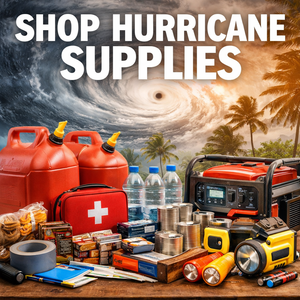
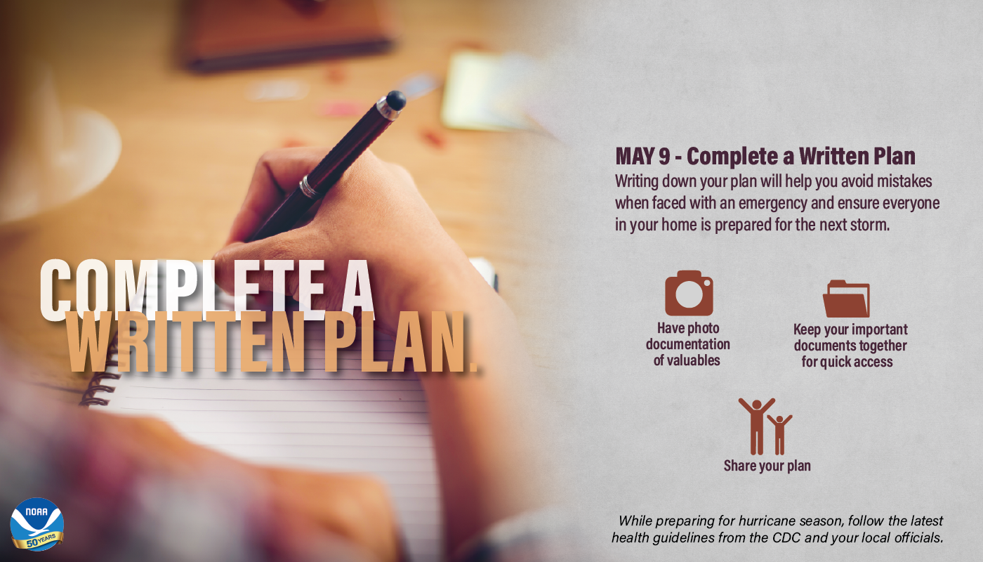
The time to prepare for a hurricane is before the season begins, when you have the time and are not under pressure. If you wait until a hurricane is on your doorstep, the odds are that you will be under duress and will make the wrong decisions. Take the time now to write down your hurricane plan. Know where you will ride out the storm and get your supplies now. You don’t want to be standing in long lines when a hurricane warning is issued. Those supplies that you need will probably be sold out by the time you reach the front of the line. Being prepared, before a hurricane threatens, makes you resilient to the hurricane impacts of wind and water. It will mean the difference between your being a hurricane victim and a hurricane survivor.
Thanks to NOAA for the above graphic!

Thanks to NOAA for the above graphic!
Here are templates that you can download, print, and fill out to help you in making a plan:
Here are a few easy steps to start your emergency communication plan:
More information to complete your written hurricane plan can be found at Ready.gov/MakeAPlan!
- For parents (PDF)
- For kids (PDF)
- For transit commuters (PDF)
- For your wallet (PDF)
- Steps to make a plan (PDF)
- Tips on emergency alerts and warnings (PDF)
Here are a few easy steps to start your emergency communication plan:
- Understand how to receive emergency alerts and warnings.
Make sure all household members are able to get alerts about an emergency from local officials. Check with your local emergency management agency to see what is available in your area, and learn more about alerts by visiting: www.ready.gov/alerts. - Discuss family/household plans for disasters that may affect your area and plan where to go.
Plan together in advance so that everyone in the household understands where to go during a different type of disaster like a hurricane, tornado, or wildfire. - Collect information.
Create a paper copy of the contact information for your family that includes: - phone (work, cell, office)
- social media
- medical facilities, doctors, service providers
- school
- Identify information and pick an emergency meeting place.
Things to consider: - Decide on safe, familiar places where your family can go for protection or to reunite.
- Make sure these locations are accessible for household members with disabilities or access and functional needs.
- If you have pets or service animals, think about animal-friendly locations.
- In your neighborhood: A mailbox at the end of the driveway, or a neighbor’s house.
- Outside of your neighborhood: library, community center, place of worship, or family friend’s home.
- Outside of your town or city: home of a relative or family friend. Make sure everyone knows the address of the meeting place and discuss ways you would get there.
Examples of meeting places:
- Share information.
Make sure everyone carries a copy in his or her backpack, purse, or wallet. You should also post a copy in a central location in your home, such as your refrigerator or family bulletin board. - Practice your plan.
Have regular household meetings to review your emergency plans, communication plans and meeting place after a disaster, and then practice, just like you would a fire drill.
More information to complete your written hurricane plan can be found at Ready.gov/MakeAPlan!
Complete Hurricane Preparedness Guide:
Determine Your Risk
Develop An Evacuation Plan
Assemble Disaster Supplies
Secure An Insurance Checkup
Strengthen Your Home
Check On Your Neighbor
Complete Your Written Hurricane Plan
Develop An Evacuation Plan
Assemble Disaster Supplies
Secure An Insurance Checkup
Strengthen Your Home
Check On Your Neighbor
Complete Your Written Hurricane Plan