260 Visitors Tracking The Tropics!
PLEASE SUPPORT TRACK THE TROPICS
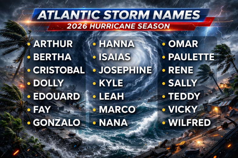
Track The Tropics is the #1 source to track the tropics 24/7! Since 2013 the main goal of the site is to bring all of the important links and graphics to ONE PLACE so you can keep up to date on any threats to land during the Atlantic Hurricane Season! Hurricane Season 2026 in the Atlantic starts on June 1st and ends on November 30th. Do you love Spaghetti Models? Well you've come to the right place!! Remember when you're preparing for a storm: Run from the water; hide from the wind!
Tropical Atlantic Weather Resources
- NOAA National Hurricane Center
- International Meteorology Database
- FSU Tropical Cyclone Track Probabilities
- Brian McNoldy Atlantic Headquarters
- Brian McNoldy Tropical Satellite Sectors
- Brian McNoldy Infrared Hovmoller
- Brian McNoldy Past TC Radar Loops
- Weather Nerds TC Guidance
- Twister Data Model Guidance
- NOAA Tropical Cyclone Tracks
- Albany GFS/ EURO Models/ Ensembles
- Albany Tropical Cyclone Guidance
- Albany Tropical Atlantic Model Maps
- Pivotal Weather Model Guidance
- Weather Online Model Guidance
- UKMet Model Guidance/ Analysis/ Sat
- ECMWF (EURO) Model Guidance
- FSU Tropical Model Outputs
- FSU Tropical Cyclone Genesis
- Penn State Tropical E-Wall
- NOAA HFIP Ruc Models
- Navy NRL TC Page
- College of DuPage Model Guidance
- WXCharts Model Guidance
- NOAA NHC Analysis Tools
- NOAA NHC ATCF Directory
- NOAA NCEP/EMC Cyclogenesis Tracking
- NOAA NCEP/EMC HWRF Model
- NOAA HFIP Model Products
- University of Miami Ocean Heat
- COLA Max Potential Hurricane Intensity
- Colorado State RAMMB TC Tracking
- Colorado State RAMMB Floaters
- Colorado State RAMMB GOES-16 Viewer
- NOAA NESDIS GOES Satellite
- ASCAT Ocean Surface Winds METOP-A
- ASCAT Ocean Surface Winds METOP-B
- Michael Ventrice Waves / MJO Maps
- TropicalAtlantic.com Analysis / Recon
- NCAR/RAL Tropical Cyclone Guidance
- CyclonicWX Tropical Resources
Historic Louisiana Storms By Month
January
June
July
August
September
October
Tropical Storm Gonzalo Archive – 2020 Hurricane Season
| Tropical Storm Gonzalo (SSHWS) | |
| Duration | July 21 – July 25 |
|---|---|
| Peak intensity | 65 mph (100 km/h) (1-min) 997 mbar (hPa) |
Gonzalo was the earliest recorded seventh named storm in the Atlantic basin. The previous record holder was Tropical Storm Gert, which formed on July 24, 2005.[131] On July 23, hurricane watches were issued for Barbados, St Vincent and the Grenadines, and a tropical storm watch was issued later that day for Grenada and Trinidad and Tobago.[132] After Gonzalo failed to strengthen into a hurricane on July 24, the hurricane and tropical storm watches were replaced with tropical storm warnings.[133] Tropical Storm Gonzalo brought squally weather to Trinidad and Tobago and parts of southern Grenada and northern Venezuela on July 25.[134] However, the storm's impact ended up being significantly smaller than originally anticipated.[135] The Tobago Emergency Management Agency only received two reports of damage on the island: a fallen tree on a health facility in Les Coteaux and a damaged bus stop roof in Argyle.[136]

 DONATE


