
SHOW ME SOME LOVE AND SUPPORT
Website: TrackTheTropics.com/DONATE
Venmo: @TrackTheTropicsLouisiana
Cash App: Cash.App/$TrackTheTropics
Subscribe: FB.com/TrackTheTropics
Website: TrackTheTropics.com/DONATE
Venmo: @TrackTheTropicsLouisiana
Cash App: Cash.App/$TrackTheTropics
Subscribe: FB.com/TrackTheTropics

Earn CASH Back On Gas $$$$ 
Shop Store For Essentials
Projected Path with Watches and Warnings

Zoomed In Watches and Warnings

Additional Projected Path Swath

Tropical Storm Force Wind Probs

Most Likely Arrival Time of Tropical Storm Force Winds

Most Reasonable Arrival Time of Tropical Storm Force Winds

Hurricane Force Wind Probabilities

Tropical Storm Force Wind Probabilities

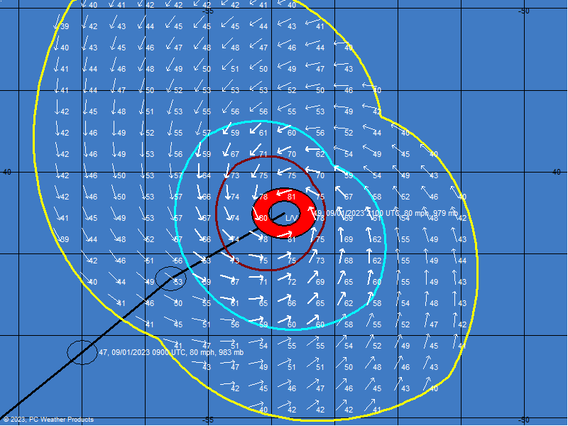
Surface Wind Field

Cumulative Wind History

Windfield
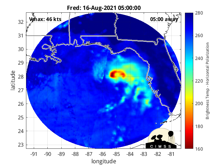
Microwave Imagery
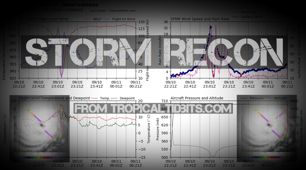
NOAA NESDIS Floaters


Peak Storm Surge Forecast


Potential Storm Surge Flooding Map (Inundation)
Additional Potential Storm Surge Map
Potential Storm Surge Flooding Map (Inundation)
Additional Potential Storm Surge Map
Flash Flood Risk


Storm Rainfall Forecast


LIVE Power Outage Map
SPC Watches and Warnings

Windshear Around Storm

Dry Air/ Water Vapor Around Storm
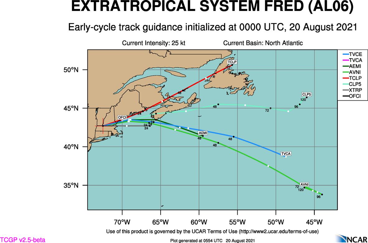
Past Track History

Top Analog Tracks

Key Messages

WeatherNerds.org Floaters

|

|

|

|
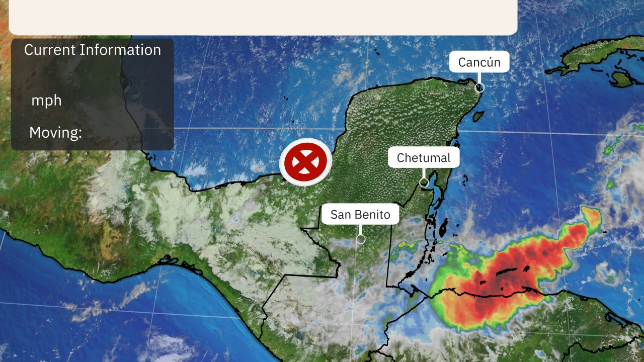
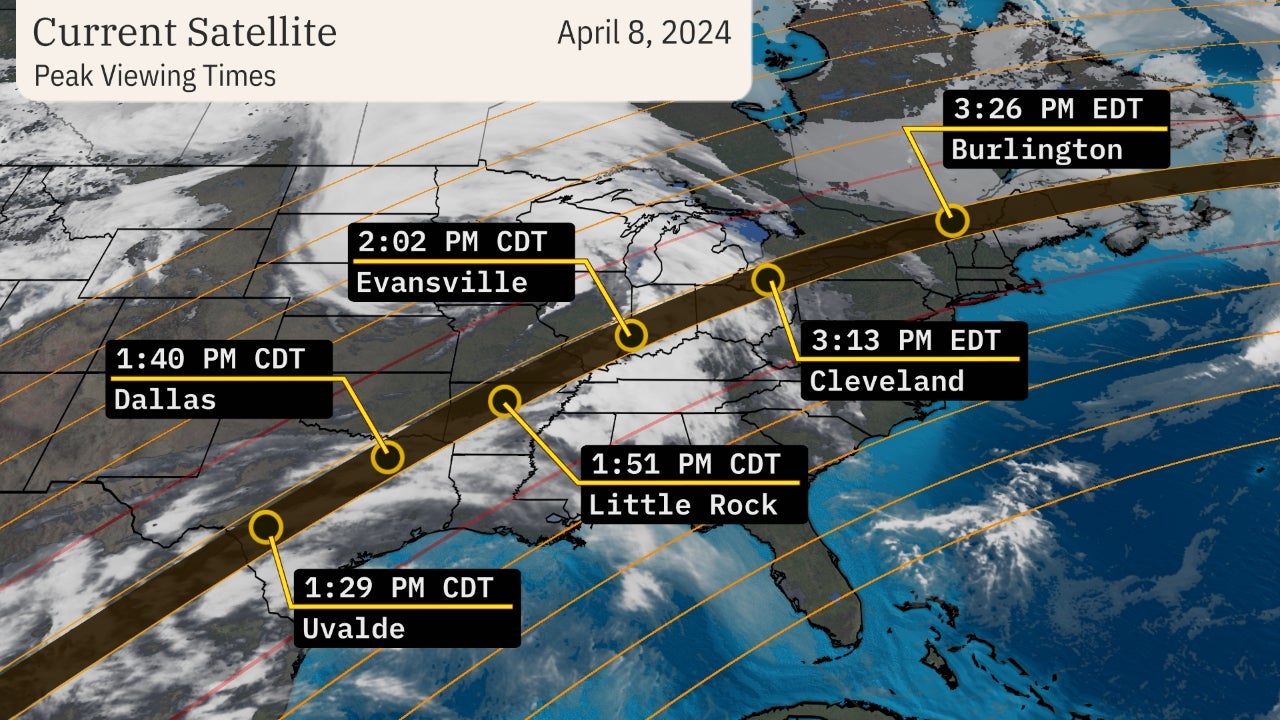
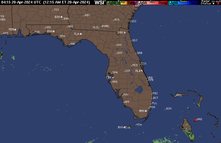
Current Radar and Satellite

Radar Loops Nearby

Intensity Forecasts

Model Tracks


GFS / Canadian Ensemble Tracks

EURO Ensemble Tracks
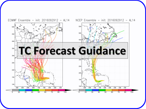
EPS Ensemble Tracks

2 Day Tropical Weather Outlook
5 Day Tropical Weather Outlook