
376 Visitors Tracking The Tropics!
SHOW ME SOME LOVE AND SUPPORT
Website: TrackTheTropics.com/DONATE
Venmo: @TrackTheTropicsLouisiana
Cash App: Cash.App/$TrackTheTropics
Subscribe: FB.com/TrackTheTropics
Website: TrackTheTropics.com/DONATE
Venmo: @TrackTheTropicsLouisiana
Cash App: Cash.App/$TrackTheTropics
Subscribe: FB.com/TrackTheTropics
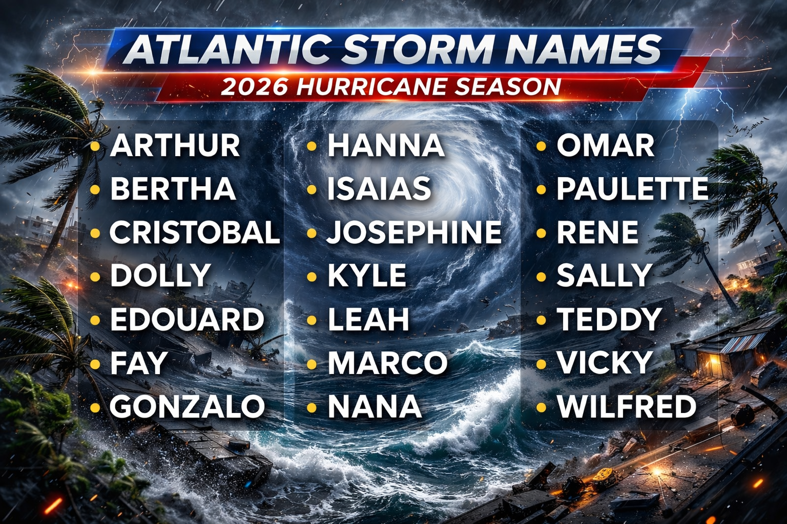
Track The Tropics is the #1 source to track the tropics 24/7! Since 2013 the main goal of the site is to bring all of the important links and graphics to ONE PLACE so you can keep up to date on any threats to land during the Atlantic Hurricane Season! Hurricane Season 2026 in the Atlantic starts on June 1st and ends on November 30th. Do you love Spaghetti Models? Well you've come to the right place!! Remember when you're preparing for a storm: Run from the water; hide from the wind!
Tropical Atlantic Weather Resources
- NOAA National Hurricane Center
- International Meteorology Database
- FSU Tropical Cyclone Track Probabilities
- Brian McNoldy Atlantic Headquarters
- Brian McNoldy Tropical Satellite Sectors
- Brian McNoldy Infrared Hovmoller
- Brian McNoldy Past TC Radar Loops
- Weather Nerds TC Guidance
- Twister Data Model Guidance
- NOAA Tropical Cyclone Tracks
- Albany GFS/ EURO Models/ Ensembles
- Albany Tropical Cyclone Guidance
- Albany Tropical Atlantic Model Maps
- Pivotal Weather Model Guidance
- Weather Online Model Guidance
- UKMet Model Guidance/ Analysis/ Sat
- ECMWF (EURO) Model Guidance
- FSU Tropical Model Outputs
- FSU Tropical Cyclone Genesis
- Penn State Tropical E-Wall
- NOAA HFIP Ruc Models
- Navy NRL TC Page
- College of DuPage Model Guidance
- WXCharts Model Guidance
- NOAA NHC Analysis Tools
- NOAA NHC ATCF Directory
- NOAA NCEP/EMC Cyclogenesis Tracking
- NOAA NCEP/EMC HWRF Model
- NOAA HFIP Model Products
- University of Miami Ocean Heat
- COLA Max Potential Hurricane Intensity
- Colorado State RAMMB TC Tracking
- Colorado State RAMMB Floaters
- Colorado State RAMMB GOES-16 Viewer
- NOAA NESDIS GOES Satellite
- ASCAT Ocean Surface Winds METOP-A
- ASCAT Ocean Surface Winds METOP-B
- Michael Ventrice Waves / MJO Maps
- TropicalAtlantic.com Analysis / Recon
- NCAR/RAL Tropical Cyclone Guidance
- CyclonicWX Tropical Resources
Historic Louisiana Storms By Month
January
June
July
August
September
October
Hurricane Teddy – 2020 Hurricane Season
Storm Tracking Important Links:
FSU Track Probability /
NOAA Tracker /
Albany Tracker -
Navy NRL Page /
HFIP Products /
TropicalAtlantic Tracker /
NCAR Guidance Page /
CyclonicWX Tracker Products /
CIMSS Tracker / TropicalTidbits Tracker / UWM Tracker / SFWMD Models
- Thu, 03 Sep 2026 08:31:26 +0000: Atlantic Remnants of Edouard Advisory Number 12 - Atlantic Remnants of Edouard Advisory Number 12
000
WTNT35 KWNH 030831
TCPAT5
BULLETIN
Remnants Of Edouard Advisory Number 12
NWS Weather Prediction Center College Park MD AL052026
400 AM CDT Thu Sep 03 2026
...EDOUARD'S REMNANTS WILL CONTINUE TO PRODUCE HEAVY RAINFALL AND
FLOODING THROUGH THURSDAY...
SUMMARY OF 400 AM CDT...0900 UTC...INFORMATION
----------------------------------------------
LOCATION...32.5N 96.5W
ABOUT 40 MI...65 KM SE OF DALLAS TEXAS
ABOUT 65 MI...105 KM W OF TYLER TEXAS
MAXIMUM SUSTAINED WINDS...25 MPH...35 KM/H
PRESENT MOVEMENT...WNW OR 300 DEGREES AT 5 MPH...7 KM/H
MINIMUM CENTRAL PRESSURE...1012 MB...29.89 INCHES
WATCHES AND WARNINGS
--------------------
CHANGES WITH THIS ADVISORY:
None.
SUMMARY OF WATCHES AND WARNINGS IN EFFECT:
Flood Watches remain in effect in much of east Texas.
DISCUSSION AND OUTLOOK
----------------------
At 400 AM CDT (0900 UTC), the remnants of Edouard were located near
latitude 32.5 North, longitude 96.5 West. The remnants are moving
toward the west-northwest near 5 mph (7 km/h) and this motion is
expected to continue until dissipation.
Maximum sustained winds are near 25 mph (35 km/h) with higher gusts.
Slow weakening to dissipation is forecast during the next 24 hours.
The estimated minimum central pressure is 1012 mb (29.89 inches).
HAZARDS AFFECTING LAND
----------------------
Key messages for Tropical Depression Edouard can be found in the
Tropical Cyclone Discussion under AWIPS header MIATCDAT5 and WMO
header WTNT45 KNHC.
RAINFALL: Additional rainfall totals of 2 to 4 inches are possible
across northeast Texas Thursday. This will bring total rainfall
amounts along the path of Edouard to 5 to 10 inches, with maximum
totals up to 22 inches. Additional flash flooding is possible
through Thursday, especially in low-lying and urban areas. Isolated
moderate to major river flooding is expected.
For a complete depiction of forecast rainfall associated with
Edouard, please see the National Weather Service Storm Total
Rainfall Graphic available at
hurricanes.gov/graphics_at5.shtml?rainqpf and the Flash Flood Risk
graphic at hurricanes.gov/graphics_at5.shtml?ero.
For a list of rainfall observations and wind reports associated
with Edouard, see the companion storm summary at WBCSCCNS5 with the
WMO header ACUS45 KWBC or at the following link:
www.wpc.ncep.noaa.gov/discussions/nfdscc5.html.
NEXT ADVISORY
-------------
This is the last public advisory issued by the Weather Prediction
Center on this system.
$$
Forecaster Gallina
- Thu, 03 Sep 2026 08:31:56 +0000: Atlantic Remnants of Edouard Forecast/Advisory Num... - Atlantic Remnants of Edouard Forecast/Advisory Number 12
000
WTNT25 KWNH 030831
TCMAT5
REMNANTS OF EDOUARD FORECAST/ADVISORY NUMBER 12
NWS WEATHER PREDICTION CENTER COLLEGE PARK MD AL052026
0900 UTC THU SEP 03 2026
REMNANTS OF CENTER LOCATED NEAR 32.5N 96.5W AT 03/0900Z
POSITION ACCURATE WITHIN 20 NM
PRESENT MOVEMENT TOWARD THE WEST-NORTHWEST OR 300 DEGREES AT 4 KT
ESTIMATED MINIMUM CENTRAL PRESSURE 1012 MB
MAX SUSTAINED WINDS 20 KT WITH GUSTS TO 30 KT.
WINDS AND SEAS VARY GREATLY IN EACH QUADRANT. RADII IN NAUTICAL
MILES ARE THE LARGEST RADII EXPECTED ANYWHERE IN THAT QUADRANT.
REPEAT...CENTER LOCATED NEAR 32.5N 96.5W AT 03/0900Z
AT 03/0600Z CENTER WAS LOCATED NEAR 32.4N 96.3W
FORECAST VALID 03/1800Z 32.9N 97.0W...DISSIPATED
MAX WIND 15 KT...GUSTS 20 KT.
FORECAST VALID 04/0600Z...DISSIPATED
REQUEST FOR 3 HOURLY SHIP REPORTS WITHIN 300 MILES OF 32.5N 96.5W
THIS IS THE LAST FORECAST/ADVISORY ISSUED BY THE
NATIONAL HURRICANE CENTER ON THIS SYSTEM
$$
FORECASTER GALLINA
- Thu, 03 Sep 2026 08:32:57 +0000: Atlantic Remnants of Edouard Discussion Number 12 - Atlantic Remnants of Edouard Discussion Number 12
000
WTNT45 KWNH 030832
TCDAT5
Remnants Of Edouard Discussion Number 12
NWS Weather Prediction Center College Park MD AL052026
400 AM CDT Thu Sep 03 2026
Rainfall forecasts for the United States can always be found at
https://www.wpc.ncep.noaa.gov/qpf/qpf2.shtml
and outlooks of flash flood risks can be found at
https://www.wpc.ncep.noaa.gov/qpf/excessive_rainfall_outlook_ero.php
For a list of rainfall observations and wind reports associated
with Edouard, see the companion storm summary at WBCSCCNS5 with the
WMO header ACUS45 KWBC or at the following link:
www.wpc.ncep.noaa.gov/discussions/nfdscc5.html.
Key Messages:
1. Scattered heavy rain in the vicinity of the remnants of Edouard
will continue over portions of eastern Texas through Thursday..
Additional flash flooding is possible along with isolated moderate
to major river flooding.
FORECAST POSITIONS AND MAX WINDS
INIT 03/0900Z 32.5N 96.5W 20 KT 25 MPH
12H 03/1800Z 32.9N 97.0W 15 KT 15 MPH...DISSIPATED
24H 04/0600Z...DISSIPATED
$$
Forecaster Gallina