
SHOW ME SOME LOVE AND SUPPORT
Website: TrackTheTropics.com/DONATE
Venmo: @TrackTheTropicsLouisiana
Cash App: Cash.App/$TrackTheTropics
Subscribe: FB.com/TrackTheTropics
Website: TrackTheTropics.com/DONATE
Venmo: @TrackTheTropicsLouisiana
Cash App: Cash.App/$TrackTheTropics
Subscribe: FB.com/TrackTheTropics

Earn CASH Back On Gas $$$$ 
Shop Store For Essentials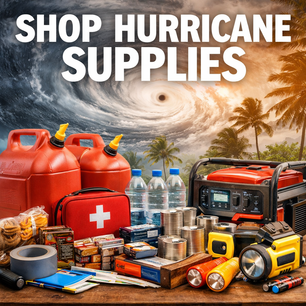
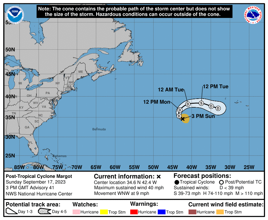
Projected Path with Watches and Warnings
NOAA NESDIS Floaters


WeatherNerds.org Floaters

|

|

|

|

Most Likely Arrival Time of Tropical Storm Force Winds

Most Reasonable Arrival Time of Tropical Storm Force Winds

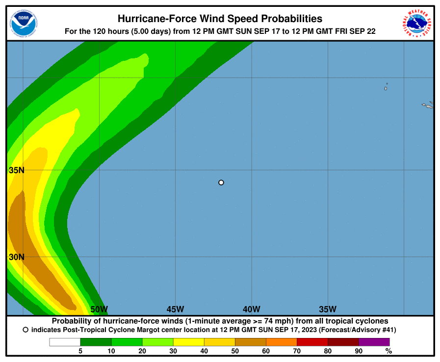
Hurricane Force Wind Probabilities
Tropical Storm Force Wind Probabilities

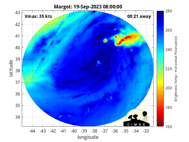
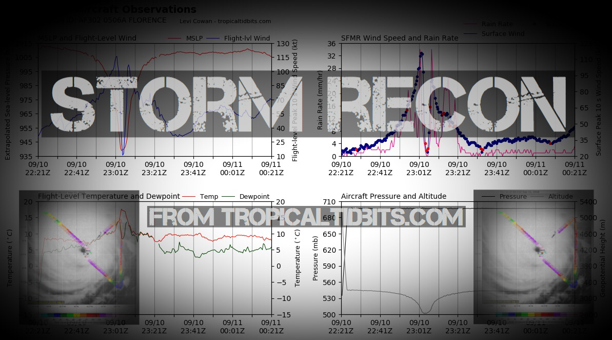
Microwave Imagery
Average Days For System To Reach U.S.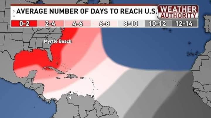
Windshear Around Storm

Dry Air/ Water Vapor Around Storm

Past Track History

Top Analog Tracks

Surface Wind Field

Cumulative Wind History

Intensity Forecasts

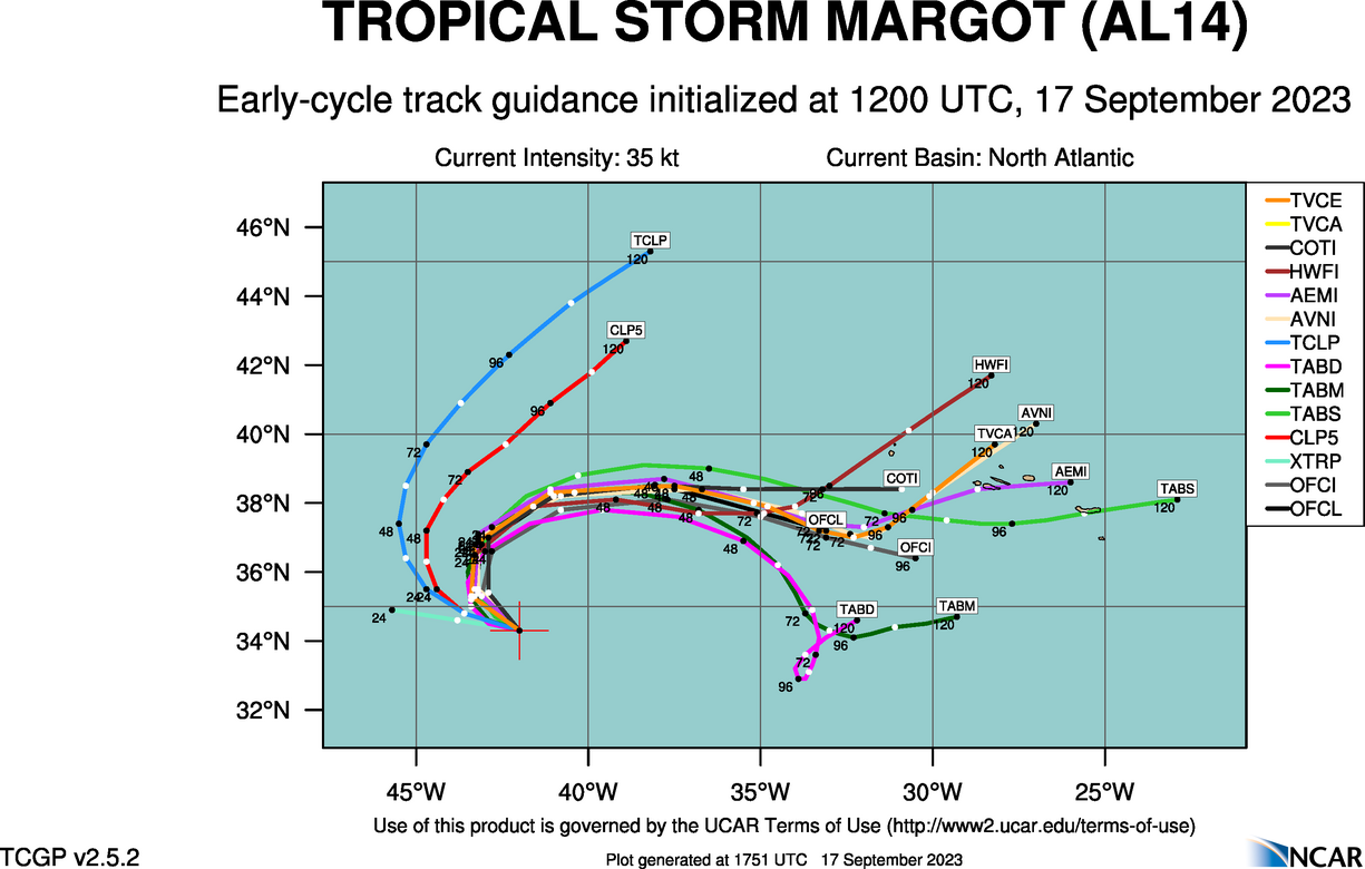
Model Tracks


GFS / Canadian Ensemble Tracks

EURO Ensemble Tracks
EPS Ensemble Tracks

2 Day Tropical Weather Outlook
7 Day Tropical Weather Outlook