SUPPORT TRACK THE TROPICS
Over the last decade plus if you appreciate the information and tracking I provide during the season along with this website which donations help keep it running please consider a one time... recurring or yearly donation if you are able to help me out...
Venmo: @TrackTheTropicsLouisiana
Website: TrackTheTropics.com/DONATE
Venmo: @TrackTheTropicsLouisiana
Website: TrackTheTropics.com/DONATE
Track The Tropics is the #1 source to track the tropics 24/7! Since 2013 the main goal of the site is to bring all of the important links and graphics to ONE PLACE so you can keep up to date on any threats to land during the Atlantic Hurricane Season! Hurricane Season 2025 in the Atlantic starts on June 1st and ends on November 30th. Do you love Spaghetti Models? Well you've come to the right place!! Remember when you're preparing for a storm: Run from the water; hide from the wind!
Tropical Atlantic Weather Resources
- NOAA National Hurricane Center
- International Meteorology Database
- FSU Tropical Cyclone Track Probabilities
- Brian McNoldy Atlantic Headquarters
- Brian McNoldy Tropical Satellite Sectors
- Brian McNoldy Infrared Hovmoller
- Brian McNoldy Past TC Radar Loops
- Weather Nerds TC Guidance
- Twister Data Model Guidance
- NOAA Tropical Cyclone Tracks
- Albany GFS/ EURO Models/ Ensembles
- Albany Tropical Cyclone Guidance
- Albany Tropical Atlantic Model Maps
- Pivotal Weather Model Guidance
- Weather Online Model Guidance
- UKMet Model Guidance/ Analysis/ Sat
- ECMWF (EURO) Model Guidance
- FSU Tropical Model Outputs
- FSU Tropical Cyclone Genesis
- Penn State Tropical E-Wall
- NOAA HFIP Ruc Models
- Navy NRL TC Page
- College of DuPage Model Guidance
- WXCharts Model Guidance
- NOAA NHC Analysis Tools
- NOAA NHC ATCF Directory
- NOAA NCEP/EMC Cyclogenesis Tracking
- NOAA NCEP/EMC HWRF Model
- NOAA HFIP Model Products
- University of Miami Ocean Heat
- COLA Max Potential Hurricane Intensity
- Colorado State RAMMB TC Tracking
- Colorado State RAMMB Floaters
- Colorado State RAMMB GOES-16 Viewer
- NOAA NESDIS GOES Satellite
- ASCAT Ocean Surface Winds METOP-A
- ASCAT Ocean Surface Winds METOP-B
- Michael Ventrice Waves / MJO Maps
- TropicalAtlantic.com Analysis / Recon
- NCAR/RAL Tropical Cyclone Guidance
- CyclonicWX Tropical Resources
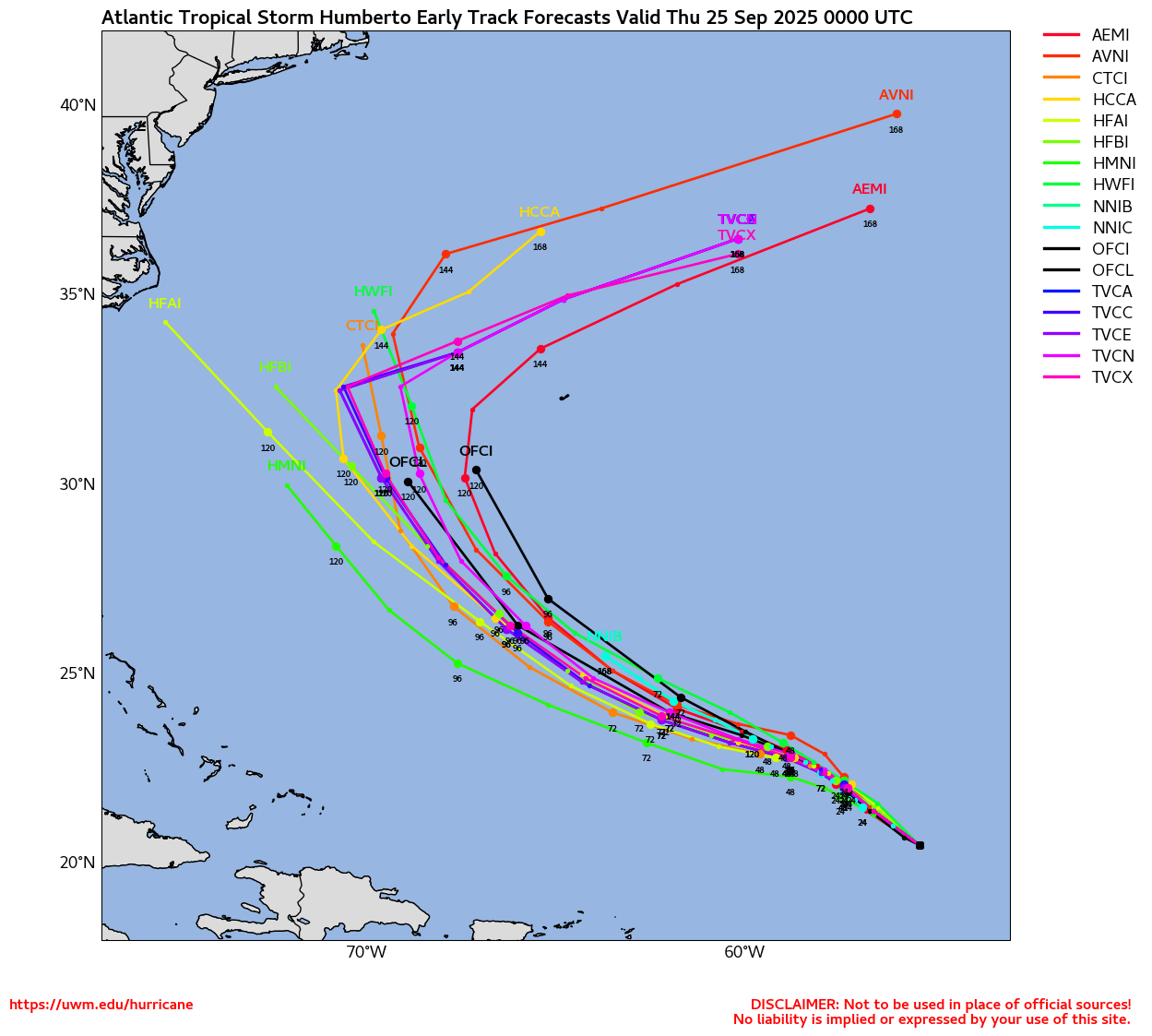
Tracking Humberto – 2025 Atlantic Hurricane Season
NHC Important Links: NHC Discussion / Public Advisory / Forecast Advisory / Wind Probs / NWS Local Products / US Watch/Warning / Graphics / Storm Archive
Storm Tracking Important Links:
Wind Analysis /
Coastal Inundation Info /
Tide Information /
Surge Map /
Surge Potential /
Coastal Risk Map /
Microwave Imagery /
Advanced Dvorak ADT /
GOES19 Satellite Storm Page /
FSU Track Probability /
Colorado State Tracker
/
Navy NRL Page
/
NHC Best Track
/
NOAA AOML Tracker
/
Tropical Atlantic
/
NCAR Guidance Page /
CyclonicWX
/
CIMSS Tracker
/ Tropical Tidbits
/ UWM Tracker
/ WeatherNerds
NOAA NESDIS Floaters


 Other Floaters:WeatherNerds - NRL Floaters - CyclonicWx - RAMMB Sat -
RAMMB Model Data -
RAMMB Wind Products


 Other Floaters:WeatherNerds - NRL Floaters - CyclonicWx - RAMMB Sat -
RAMMB Model Data -
RAMMB Wind Products
2,394 Visitors Tracking The Tropics in the past hour!
SUPPORT TRACK THE TROPICS
Over the last decade plus if you appreciate the information and tracking I provide during the season along with this website which donations help keep it running please consider a one time... recurring or yearly donation if you are able to help me out...
NHC Public Advisory
- Sat, 27 Sep 2025 08:44:38 +0000: Atlantic Hurricane Humberto Advisory Number 11 - Atlantic Hurricane Humberto Advisory Number 11
000
WTNT33 KNHC 270844
TCPAT3
BULLETIN
Hurricane Humberto Advisory Number 11
NWS National Hurricane Center Miami FL AL082025
500 AM AST Sat Sep 27 2025
...HUMBERTO EXPECTED TO REMAIN A POWERFUL MAJOR HURRICANE THROUGH
EARLY NEXT WEEK...
SUMMARY OF 500 AM AST...0900 UTC...INFORMATION
----------------------------------------------
LOCATION...22.3N 59.3W
ABOUT 375 MI...605 KM NE OF THE NORTHERN LEEWARD ISLANDS
MAXIMUM SUSTAINED WINDS...145 MPH...230 KM/H
PRESENT MOVEMENT...W OR 275 DEGREES AT 6 MPH...9 KM/H
MINIMUM CENTRAL PRESSURE...938 MB...27.70 INCHES
WATCHES AND WARNINGS
--------------------
There are no coastal watches or warnings in effect.
Interests in Bermuda should monitor the progress of Humberto.
DISCUSSION AND OUTLOOK
----------------------
At 500 AM AST (0900 UTC), the eye of Hurricane Humberto was
located near latitude 22.3 North, longitude 59.3 West. Humberto is
moving toward the west near 6 mph (9 km/h). By early Monday, a
turn toward the northwest at a slightly faster forward speed is
forecast followed by a turn toward the north-northwest by Monday
night.
Maximum sustained winds are near 145 mph (230 km/h) with higher
gusts. Humberto is a category 4 hurricane on the Saffir-Simpson
Hurricane Wind Scale. Additional strengthening is forecast through
the weekend.
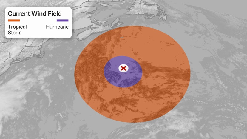
Hurricane-force winds extend outward up to 25 miles (35 km) from the
center and tropical-storm-force winds extend outward up to 105 miles
(165 km).
The estimated minimum central pressure is 938 mb (27.70 inches).
HAZARDS AFFECTING LAND
----------------------
SURF: Swells generated by Humberto will begin affecting portions of
the northern Leeward Islands, the Virgin Islands, Puerto Rico, and
Bermuda this weekend and early next week. These swells are likely to
cause life-threatening surf and rip current conditions. Please
consult products from your local weather office.
NEXT ADVISORY
-------------
Next complete advisory at 1100 AM AST.
$$
Forecaster Bucci
NHC Forecast Advisory
- Sat, 27 Sep 2025 08:44:07 +0000: Atlantic Hurricane Humberto Forecast/Advisory Numb... - Atlantic Hurricane Humberto Forecast/Advisory Number 11
000
WTNT23 KNHC 270844
TCMAT3
HURRICANE HUMBERTO FORECAST/ADVISORY NUMBER 11
NWS NATIONAL HURRICANE CENTER MIAMI FL AL082025
0900 UTC SAT SEP 27 2025
HURRICANE CENTER LOCATED NEAR 22.3N 59.3W AT 27/0900Z
POSITION ACCURATE WITHIN 20 NM
PRESENT MOVEMENT TOWARD THE WEST OR 275 DEGREES AT 5 KT
ESTIMATED MINIMUM CENTRAL PRESSURE 938 MB
MAX SUSTAINED WINDS 125 KT WITH GUSTS TO 150 KT.
64 KT....... 20NE 10SE 10SW 20NW.
50 KT....... 40NE 30SE 25SW 40NW.
34 KT....... 90NE 60SE 50SW 80NW.
4 M SEAS....150NE 120SE 105SW 120NW.
WINDS AND SEAS VARY GREATLY IN EACH QUADRANT. RADII IN NAUTICAL
MILES ARE THE LARGEST RADII EXPECTED ANYWHERE IN THAT QUADRANT.
REPEAT...CENTER LOCATED NEAR 22.3N 59.3W AT 27/0900Z
AT 27/0600Z CENTER WAS LOCATED NEAR 22.2N 58.9W
FORECAST VALID 27/1800Z 22.6N 60.5W
MAX WIND 135 KT...GUSTS 165 KT.
64 KT... 25NE 20SE 20SW 30NW.
50 KT... 50NE 40SE 30SW 40NW.
34 KT...110NE 80SE 60SW 90NW.
FORECAST VALID 28/0600Z 23.3N 62.3W
MAX WIND 140 KT...GUSTS 170 KT.
64 KT... 30NE 25SE 20SW 30NW.
50 KT... 60NE 50SE 40SW 40NW.
34 KT...120NE 90SE 70SW 90NW.
FORECAST VALID 28/1800Z 24.4N 64.3W
MAX WIND 135 KT...GUSTS 165 KT.
64 KT... 35NE 30SE 25SW 30NW.
50 KT... 60NE 50SE 40SW 50NW.
34 KT...120NE 90SE 70SW 100NW.
FORECAST VALID 29/0600Z 25.8N 66.0W
MAX WIND 130 KT...GUSTS 160 KT.
64 KT... 40NE 30SE 30SW 35NW.
50 KT... 70NE 60SE 50SW 50NW.
34 KT...120NE 100SE 70SW 100NW.
FORECAST VALID 29/1800Z 27.3N 67.3W
MAX WIND 125 KT...GUSTS 150 KT.
64 KT... 40NE 40SE 30SW 40NW.
50 KT... 70NE 60SE 50SW 60NW.
34 KT...120NE 110SE 80SW 110NW.
FORECAST VALID 30/0600Z 29.1N 68.1W
MAX WIND 115 KT...GUSTS 140 KT.
64 KT... 50NE 40SE 30SW 40NW.
50 KT... 80NE 70SE 50SW 60NW.
34 KT...130NE 130SE 90SW 120NW.
EXTENDED OUTLOOK. NOTE...ERRORS FOR TRACK HAVE AVERAGED NEAR 125 NM
ON DAY 4 AND 175 NM ON DAY 5...AND FOR INTENSITY NEAR 15 KT EACH DAY
OUTLOOK VALID 01/0600Z 33.4N 66.5W
MAX WIND 100 KT...GUSTS 120 KT.
50 KT... 80NE 80SE 60SW 60NW.
34 KT...170NE 150SE 110SW 130NW.
OUTLOOK VALID 02/0600Z 37.7N 56.4W...POST-TROP/EXTRATROP
MAX WIND 90 KT...GUSTS 110 KT.
50 KT...100NE 120SE 110SW 80NW.
34 KT...230NE 220SE 170SW 210NW.
REQUEST FOR 3 HOURLY SHIP REPORTS WITHIN 300 MILES OF 22.3N 59.3W
NEXT ADVISORY AT 27/1500Z
$$
FORECASTER BUCCI
NHC Discussion
- Sat, 27 Sep 2025 08:45:09 +0000: Atlantic Hurricane Humberto Discussion Number 11 - Atlantic Hurricane Humberto Discussion Number 11
000
WTNT43 KNHC 270845
TCDAT3
Hurricane Humberto Discussion Number 11
NWS National Hurricane Center Miami FL AL082025
500 AM AST Sat Sep 27 2025
Humberto seems to have paused its meteoric rise for the moment.
The eye has become smaller and more distorted based on GOES
satellite imagery. An AMSR2 microwave pass showed some evidence
that the concentric rings mentioned in the previous discussion have
contracted, indicating an ongoing eyewall replacement cycle. The
microwave images also displayed classic hurricane structure, with
curved banding in all quadrants and no signs of dry air intrusions.
The satellite intensity estimates have leveled off overnight, and
the initial intensity is held at 125 kt, closest to the UW-CIMSS ADT
of T6.3.
While internal dynamics may have interrupted Humberto's
strengthening, the hurricane still has about a day of conducive
environmental and oceanic conditions to intensify. Some of the
regional hurricane models show slight strengthening, though most of
the model guidance suggests Humberto will hold generally steady for
the next couple of days. By next week, the vertical wind shear is
expected to increase and induce a gradual weakening trend. As
Humberto gains latitude, a significant expansion in the surface wind
field will likely occur while it passes west of Bermuda.
Phase-space analyses of global model forecasts by day 5 show
Humberto as an extratropical cyclone, or close to one. The latest
NHC intensity forecast is very similar to the previous prediction
and lies on the high end of the guidance in the short-term.
The hurricane is moving westward at 5 kt. A subtropical ridge
centered over the western Atlantic should slowly steer Humberto to
the west or west-northwest during the next day or so, then turn the
cyclone to the northwest and north-northwest by early next week. By
day 4, an amplifying upper-level trough moving out of the Canadian
Maritimes is expected to rapidly steer Humberto northeastward. The
NHC track forecast shifted slightly eastward this cycle and is a
little quicker at days 4 and 5. It lies between the Google DeepMind
ensemble mean and the previous prediction.
FORECAST POSITIONS AND MAX WINDS
INIT 27/0900Z 22.3N 59.3W 125 KT 145 MPH
12H 27/1800Z 22.6N 60.5W 135 KT 155 MPH
24H 28/0600Z 23.3N 62.3W 140 KT 160 MPH
36H 28/1800Z 24.4N 64.3W 135 KT 155 MPH
48H 29/0600Z 25.8N 66.0W 130 KT 150 MPH
60H 29/1800Z 27.3N 67.3W 125 KT 145 MPH
72H 30/0600Z 29.1N 68.1W 115 KT 130 MPH
96H 01/0600Z 33.4N 66.5W 100 KT 115 MPH
120H 02/0600Z 37.7N 56.4W 90 KT 105 MPH...POST-TROP/EXTRATROP
$$
Forecaster Bucci

 DONATE


