
520 Visitors Tracking The Tropics!
SHOW ME SOME LOVE AND SUPPORT
Website: TrackTheTropics.com/DONATE
Venmo: @TrackTheTropicsLouisiana
Cash App: Cash.App/$TrackTheTropics
Subscribe: FB.com/TrackTheTropics
Website: TrackTheTropics.com/DONATE
Venmo: @TrackTheTropicsLouisiana
Cash App: Cash.App/$TrackTheTropics
Subscribe: FB.com/TrackTheTropics
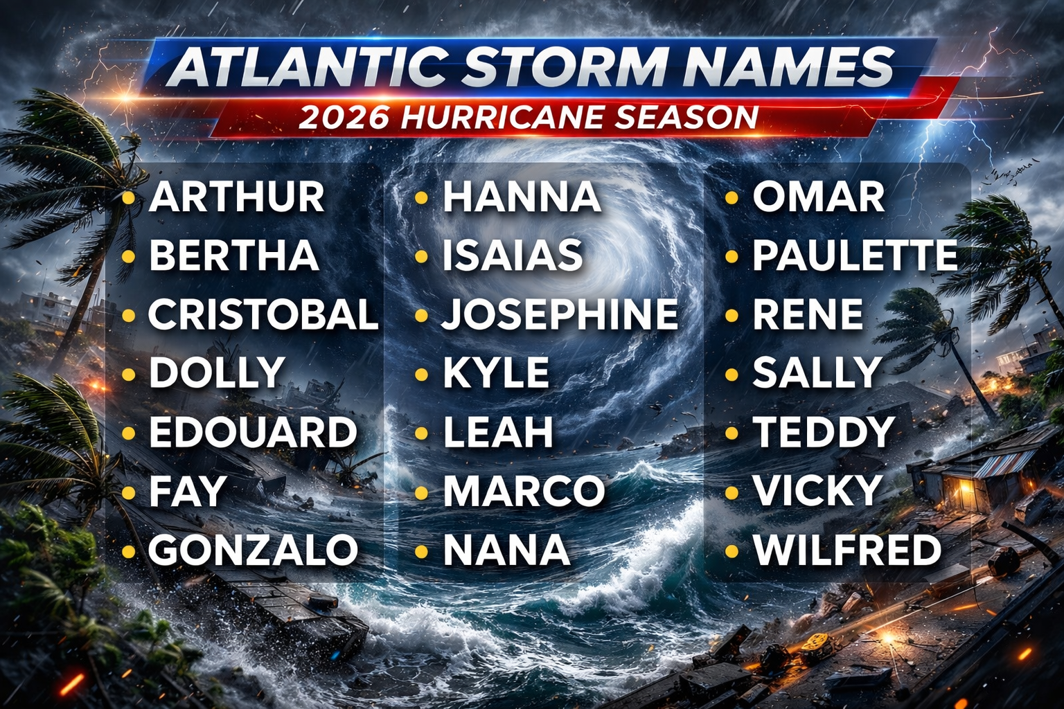
Track The Tropics is the #1 source to track the tropics 24/7! Since 2013 the main goal of the site is to bring all of the important links and graphics to ONE PLACE so you can keep up to date on any threats to land during the Atlantic Hurricane Season! Hurricane Season 2026 in the Atlantic starts on June 1st and ends on November 30th. Do you love Spaghetti Models? Well you've come to the right place!! Remember when you're preparing for a storm: Run from the water; hide from the wind!
Tropical Atlantic Weather Resources
- NOAA National Hurricane Center
- International Meteorology Database
- FSU Tropical Cyclone Track Probabilities
- Brian McNoldy Atlantic Headquarters
- Brian McNoldy Tropical Satellite Sectors
- Brian McNoldy Infrared Hovmoller
- Brian McNoldy Past TC Radar Loops
- Weather Nerds TC Guidance
- Twister Data Model Guidance
- NOAA Tropical Cyclone Tracks
- Albany GFS/ EURO Models/ Ensembles
- Albany Tropical Cyclone Guidance
- Albany Tropical Atlantic Model Maps
- Pivotal Weather Model Guidance
- Weather Online Model Guidance
- UKMet Model Guidance/ Analysis/ Sat
- ECMWF (EURO) Model Guidance
- FSU Tropical Model Outputs
- FSU Tropical Cyclone Genesis
- Penn State Tropical E-Wall
- NOAA HFIP Ruc Models
- Navy NRL TC Page
- College of DuPage Model Guidance
- WXCharts Model Guidance
- NOAA NHC Analysis Tools
- NOAA NHC ATCF Directory
- NOAA NCEP/EMC Cyclogenesis Tracking
- NOAA NCEP/EMC HWRF Model
- NOAA HFIP Model Products
- University of Miami Ocean Heat
- COLA Max Potential Hurricane Intensity
- Colorado State RAMMB TC Tracking
- Colorado State RAMMB Floaters
- Colorado State RAMMB GOES-16 Viewer
- NOAA NESDIS GOES Satellite
- ASCAT Ocean Surface Winds METOP-A
- ASCAT Ocean Surface Winds METOP-B
- Michael Ventrice Waves / MJO Maps
- TropicalAtlantic.com Analysis / Recon
- NCAR/RAL Tropical Cyclone Guidance
- CyclonicWX Tropical Resources
Historic Louisiana Storms By Month
January
June
July
August
September
October
Tracking Remnants of Dolly - 2026 Hurricane Season
NHC Important Links: NHC Discussion / Public Advisory / Forecast Advisory / Wind Probs / NWS Local Products / US Watch/Warning / Graphics / Storm Archive
Storm Tracking Important Links:
Storm Recon Missions
/
Wind Analysis /
Coastal Inundation Info /
Tide Information /
Surge Map /
Surge Potential /
Coastal Risk Map /
Microwave Imagery /
Advanced Dvorak ADT /
GOES19 Satellite Storm Page /
FSU Track Probability /
Colorado State Tracker /
Navy NRL Page
/
NOAA AOML Tracker
/
Tropical Atlantic Storm Page /
NCAR Guidance Page /
CyclonicWX Tracker /
CIMSS Tracker /UWM Tracker
/PolarWX
Other Floaters:WeatherNerds - NRL Floaters - CyclonicWx - RAMMB Sat -
RAMMB Model Data -
RAMMB Wind Products
NHC Public Advisory
- Sun, 11 Oct 2026 15:00:17 +0000: Atlantic Post-Tropical Cyclone Isaias Advisory Number 20 - Atlantic Post-Tropical Cyclone Isaias Advisory Number 20
000
WTNT34 KWNH 111500
TCPAT4
BULLETIN
Post-Tropical Cyclone Isaias Advisory Number 20
NWS Weather Prediction Center College Park MD AL092026
1100 AM EDT Sun Oct 11 2026
...FLASH FLOOD THREAT FROM ISAIAS IS DECREASING BUT SOME
RISK CONTINUES TODAY ACROSS PORTIONS OF THE APPALACHIANS AND
MID-ATLANTIC...
SUMMARY OF 1100 AM EDT...1500 UTC...INFORMATION
-----------------------------------------------
LOCATION...37.5N 84.0W
ABOUT 180 MI...285 KM NE OF NASHVILLE TENNESSEE
MAXIMUM SUSTAINED WINDS...25 MPH...35 KM/H
PRESENT MOVEMENT...ENE OR 65 DEGREES AT 22 MPH...35 KM/H
MINIMUM CENTRAL PRESSURE...1010 MB...29.83 INCHES
WATCHES AND WARNINGS
--------------------
SUMMARY OF WATCHES AND WARNINGS IN EFFECT:
Flood Watches are in effect for...
* Portions of the Central and Southern Appalachians
Wind Advisory is in effect for...
* Portions of the Central Appalachians
DISCUSSION AND OUTLOOK
----------------------
At 1100 AM EDT (1500 UTC), the center of Post-Tropical Cyclone
Isaias was located near latitude 37.5 North, longitude 84.0 West.
The post-tropical cyclone is moving toward the east-northeast near
22 mph (35 km/h) and this motion is expected to continue today
before the low dissipates over West Virginia this evening.
Maximum sustained winds are near 25 mph (35 km/h) with higher gusts.
Little change in strength is forecast during the next 12 hours,
with the low dissipating thereafter.
The estimated minimum central pressure is 1010 mb (29.83 inches).
HAZARDS AFFECTING LAND
----------------------
Key messages for Isaias can be found in the Tropical Cyclone
Discussion under AWIPS header MIATCDAT4 and WMO header WTNT44 KNHC.
RAINFALL: Additional rainfall of 1 to 3 inches is possible today
across portions of the Central Appalachians into the Mid-Atlantic,
with localized flash and urban flooding possible. In western North
Carolina, rainfall is diminishing, but rapid river rises and
flooding remain possible today.
For a complete depiction of forecast rainfall associated with
Isaias, please see the National Weather Service Storm Total Rainfall
Graphic available at
hurricanes.gov/graphics_at4.shtml?rainqpf and the Flash Flood Risk
graphic at hurricanes.gov/graphics_at4.shtml?ero.
For a list of rainfall observations (and wind reports) associated
with Isaias, see the companion storm summary at WBCSCCNS4 with the
WMO header ACUS44 KWBC or at the following link:
www.wpc.ncep.noaa.gov/discussions/nfdscc4.html.
TORNADOES: A couple of tornadoes are possible today across the
Piedmont and Coastal Plain of Virginia and North Carolina.
SURF: Swells from Isaias will continue to affect much of the
Gulf and Southeast coasts of the United States today. These swells
are likely to cause life-threatening surf and rip current
conditions. Please consult products from your local weather office.
A depiction of rip current risk for the United States can be found
at: hurricanes.gov/graphics_at4.shtml?ripCurrents
NEXT ADVISORY
-------------
This is the last public advisory issued by the Weather Prediction
Center on this system.
$$
Forecaster Chenard
NHC Forecast Advisory
- Sun, 11 Oct 2026 14:59:50 +0000: Atlantic Post-Tropical Cyclone Isaias Forecast/Adv... - Atlantic Post-Tropical Cyclone Isaias Forecast/Advisory Number 20
000
WTNT24 KWNH 111459
TCMAT4
POST-TROPICAL CYCLONE ISAIAS FORECAST/ADVISORY NUMBER 20
NWS WEATHER PREDICTION CENTER COLLEGE PARK MD AL092026
1500 UTC SUN OCT 11 2026
POST-TROPICAL CYCLONE CENTER LOCATED NEAR 37.5N 84.0W AT 11/1500Z
POSITION ACCURATE WITHIN 20 NM
PRESENT MOVEMENT TOWARD THE EAST-NORTHEAST OR 65 DEGREES AT 19 KT
ESTIMATED MINIMUM CENTRAL PRESSURE 1010 MB
MAX SUSTAINED WINDS 20 KT WITH GUSTS TO 30 KT.
WINDS AND SEAS VARY GREATLY IN EACH QUADRANT. RADII IN NAUTICAL
MILES ARE THE LARGEST RADII EXPECTED ANYWHERE IN THAT QUADRANT.
REPEAT...CENTER LOCATED NEAR 37.5N 84.0W AT 11/1500Z
AT 11/1200Z CENTER WAS LOCATED NEAR 37.3N 84.8W
FORECAST VALID 12/0000Z 38.8N 80.2W...POST-TROP/INLAND
MAX WIND 20 KT...GUSTS 30 KT.
FORECAST VALID 12/1200Z...DISSIPATED
REQUEST FOR 3 HOURLY SHIP REPORTS WITHIN 300 MILES OF 37.5N 84.0W
THIS IS THE LAST FORECAST/ADVISORY ISSUED BY THE
NATIONAL HURRICANE CENTER ON THIS SYSTEM
$$
FORECASTER CHENARD
NHC Discussion
- Sun, 11 Oct 2026 15:00:48 +0000: Atlantic Post-Tropical Cyclone Isaias Discussion Number 20 - Atlantic Post-Tropical Cyclone Isaias Discussion Number 20
000
WTNT44 KWNH 111500
TCDAT4
Post-Tropical Cyclone Isaias Discussion Number 20
NWS Weather Prediction Center College Park MD AL092026
1100 AM EDT Sun Oct 11 2026
Key Messages:
1. Areas of heavy rainfall will continue across portions of the
Central Appalachians and Mid-Atlantic today, with localized flash
and urban flooding possible. River flooding continues in western
North Carolina.
2. Swells from Isaias will continue to affect much of the Gulf and
Southeastern Atlantic coasts of the United States today. These
swells are likely to cause life-threatening surf and rip current
conditions. Please consult products from your local weather office.
3. A couple of tornadoes are possible today across the Piedmont and
Coastal Plain of Virginia and North Carolina.
FORECAST POSITIONS AND MAX WINDS
INIT 11/1500Z 37.5N 84.0W 20 KT 25 MPH...POST-TROP/INLAND
12H 12/0000Z 38.8N 80.2W 20 KT 25 MPH...POST-TROP/INLAND
24H 12/1200Z...DISSIPATED
$$
Forecaster Chenard