
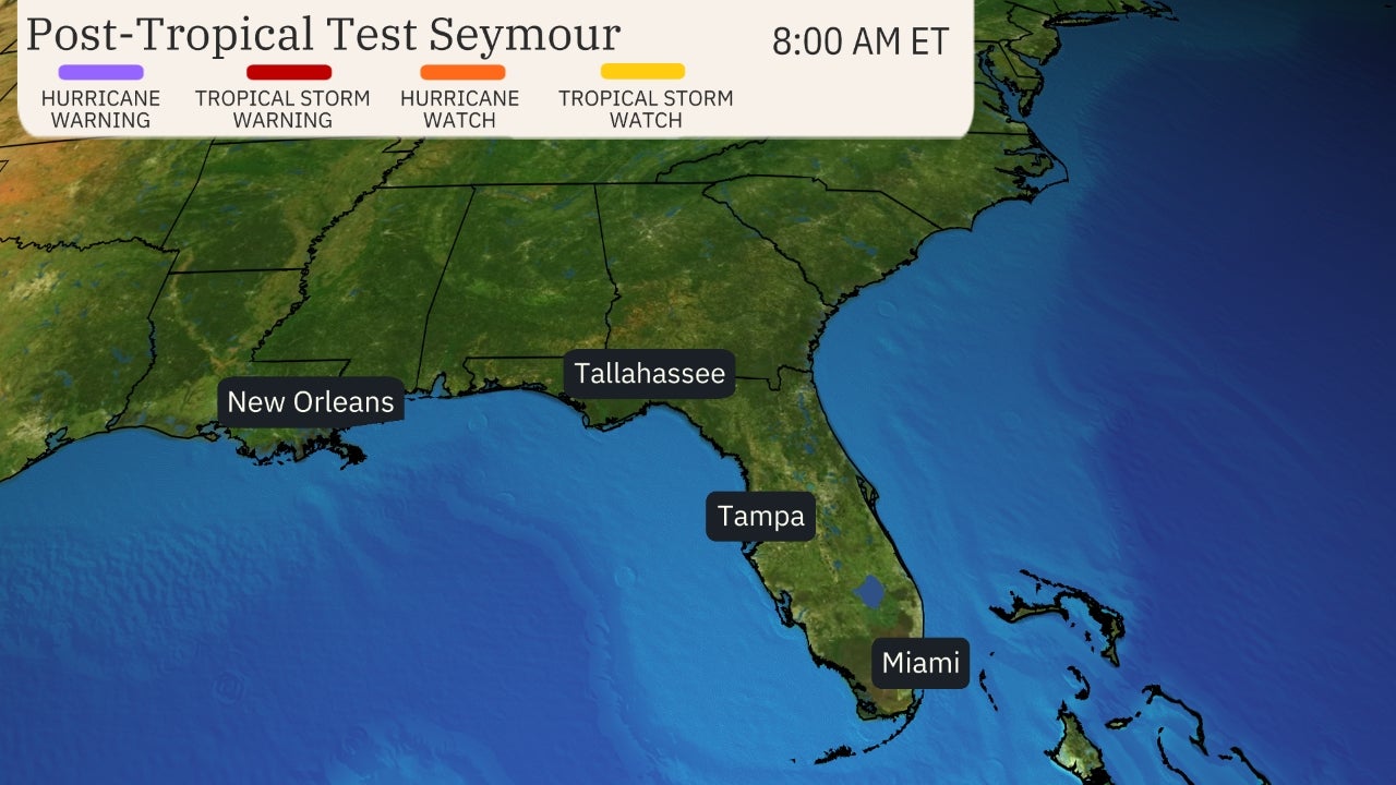
Projected Path with Watches and Warnings

Key Messages

Zoomed In Watches and Warnings
Additional Projected Path Swath

Current Radar of Storm

Current Wind Field


Most Likely Arrival Time of Tropical Storm Force Winds

Most Reasonable Arrival Time of Tropical Storm Force Winds

Hurricane Force Wind Probabilities

Tropical Storm Force Wind Probabilities

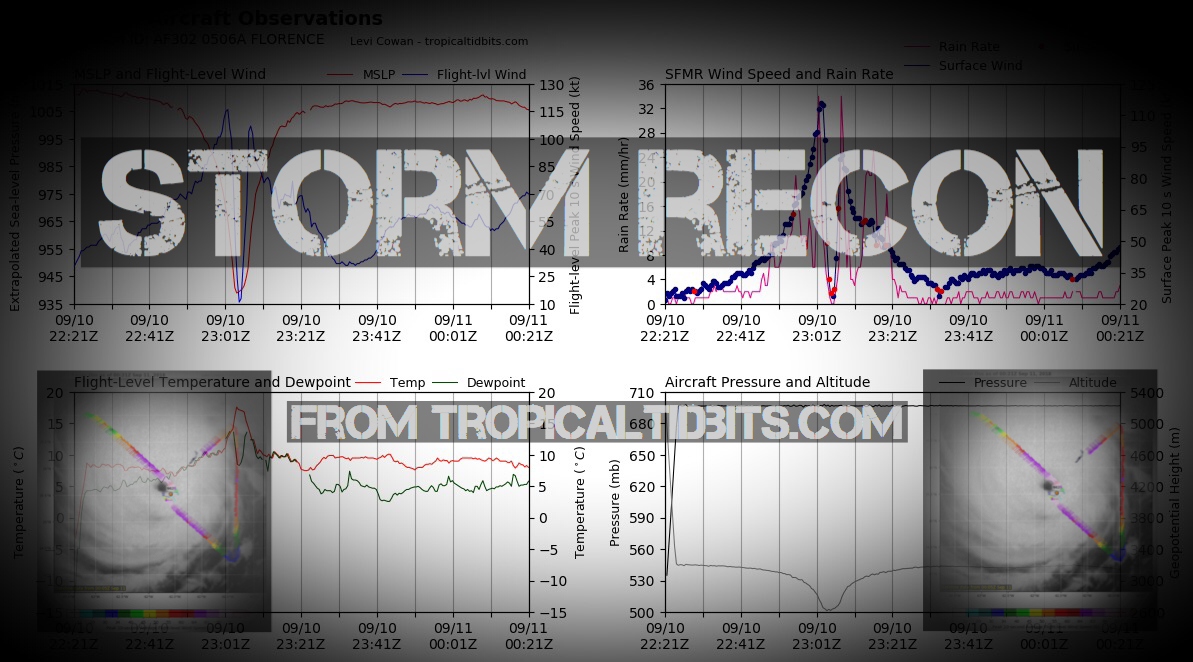
Microwave Imagery

NOAA NESDIS Floaters


Surge Forecast

Rainfall Forecast

Flash Flood Potential

Windshear Around Storm


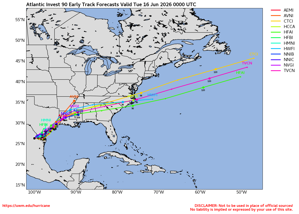
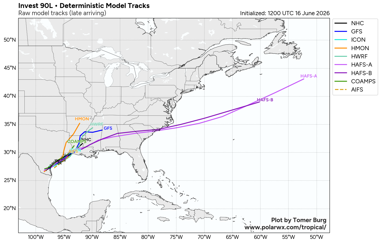
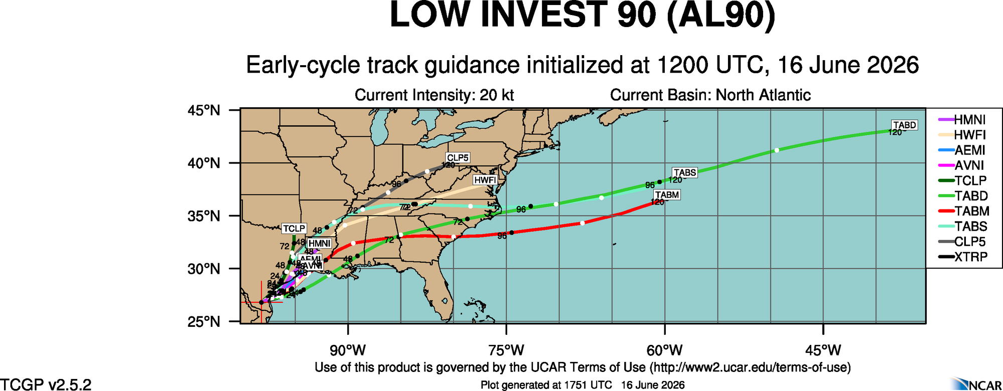
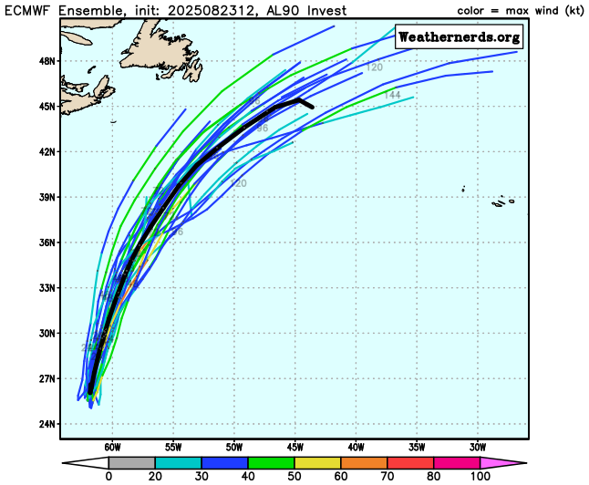
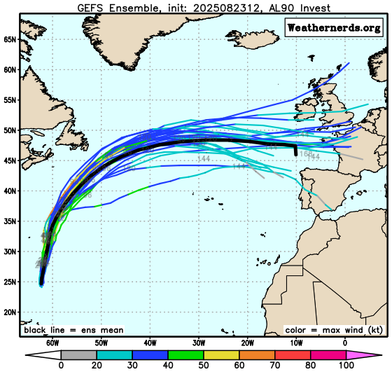
Top Analog Tracks


Earn Cash$$ Back On Gas
Shop Store For Essentials


SUPPORT TRACK THE TROPICS
Over the last decade plus if you appreciate the information and tracking I provide during the season along with this website which donations help keep it running please consider a one time... recurring or yearly donation if you are able to help me out...
LIVE Power Outage Map
SPC Watches and Warnings

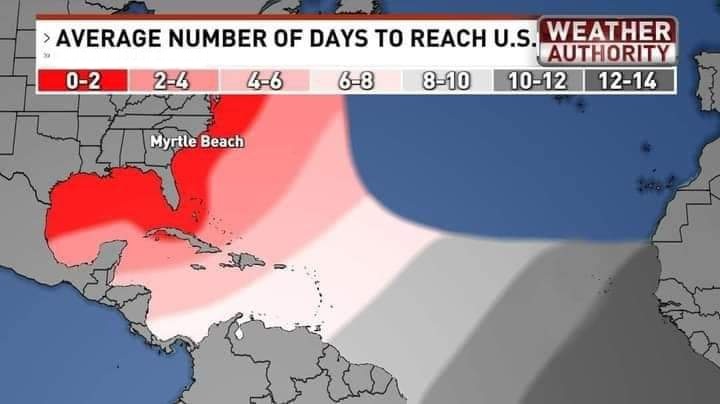
Average Days For System To Reach U.S.
2 Day Tropical Weather Outlook

7 Day Tropical Weather Outlook
