SHOW ME SOME LOVE AND SUPPORT
Website: TrackTheTropics.com/DONATE
Venmo: @TrackTheTropicsLouisiana
Cash App: Cash.App/$TrackTheTropics
Subscribe: FB.com/TrackTheTropics
Website: TrackTheTropics.com/DONATE
Venmo: @TrackTheTropicsLouisiana
Cash App: Cash.App/$TrackTheTropics
Subscribe: FB.com/TrackTheTropics

Earn CASH Back On Gas $$$$ 
Shop Store For Essentials
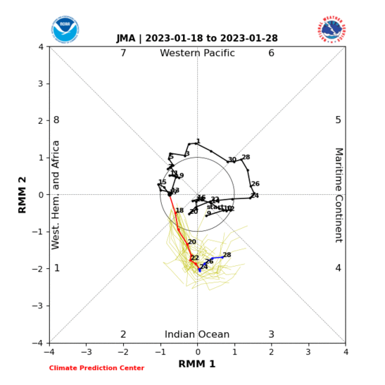
Madden-Julian Oscillation (MJO)
The Madden–Julian Oscillation (MJO) is the largest element of the intraseasonal (30–90 days) variability in the tropical atmosphere. It is a large-scale coupling between atmospheric circulation and tropical deep convection. Rather than being a standing pattern (like ENSO) it is a traveling pattern, propagating eastwards at approximately 4 to 8 m/s, through the atmosphere above the warm parts of the Indian and Pacific oceans. This overall circulation pattern manifests itself in various ways, most clearly as anomalous rainfall. This was discovered by Roland Madden and Paul Julian (again the comparison with ENSO is instructive, since their local effects on Peruvian fisheries were discovered long before the global structure of the pattern was recognized).The MJO is characterized by an eastward progression of large regions of both enhanced and suppressed tropical rainfall, observed mainly over the Indian Ocean and Pacific Ocean. The anomalous rainfall is usually first evident over the western Indian Ocean, and remains evident as it propagates over the very warm ocean waters of the western and central tropical Pacific. This pattern of tropical rainfall then generally becomes nondescript as it moves over the cooler ocean waters of the eastern Pacific (except over the region of warmer water off the west coast of Central America) but occasionally reappears at low amplitude over the tropical Atlantic and higher amplitude over the Indian Ocean. The wet phase of enhanced convection and precipitation is followed by a dry phase where thunderstorm activity is suppressed. Each cycle lasts approximately 30–60 days. Because of this pattern, The MJO is also known as the 30–60 day oscillation, 30–60 day wave, or intraseasonal oscillation.
All Model Mean Forecast

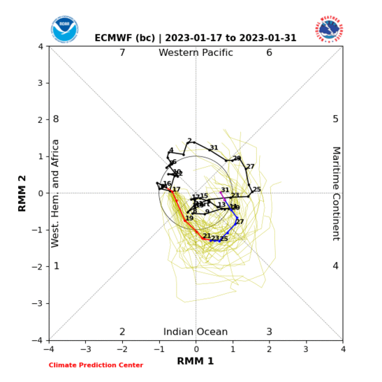
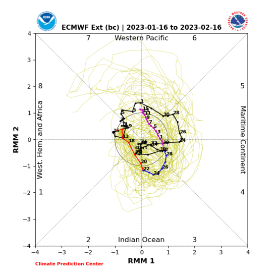
ECMWF Forecast
EMON Forecast
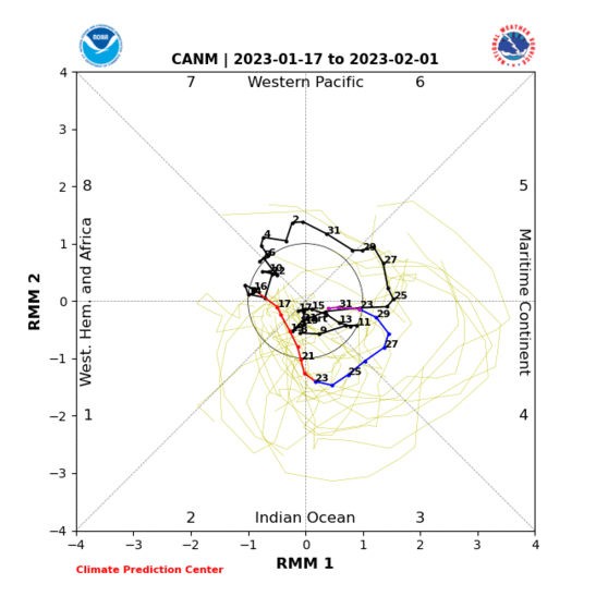
Canadian Forecast
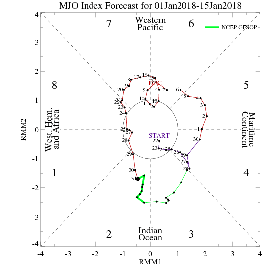
NCEP GFS OP Forecast
JMA Ensemble Forecast
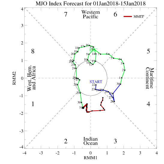
MMEF Forecastt
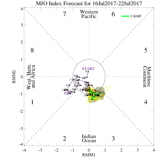
UKMET Forecast