9-15-2021 Last NHC Advisory Issued On Nicholas...
all information and graphics below will eventually stop updating.
NHC Important Links: NHC Discussion / Public Advisory / Forecast Advisory / Wind Probs / Graphics / Storm Archive
Important LOCAL Links:
NWS Brownsville, Texas / NWS Corpus Christi, Texas / NWS Houston/Galveston, Texas / NWS Lake Charles, Louisiana / NWS New Orleans/ Baton Rouge / Power Outages
Storm Tracking Important Links: Wind Analysis / Coastal Inundation Info / Tide Information / Surge Map / Surge Potential / Coastal Risk Map / Microwave Imagery / Advanced Dvorak ADT / GOES16 Satellite Storm Page / FSU Track Probability / NOAA Tracker / Albany Tracker / Navy NRL Page / HFIP Products / Tropical Atlantic Storm Page / NCAR Guidance Page / CyclonicWX Tracker / CIMSS Tracker / Tropical Tidbits Storm Page /UWM Tracker / SFWMD Models
Peak Storm Surge Forecast
Potential Storm Surge Flooding Map (Inundation)
Additional Potential Storm Surge Map
Flash Flood Risk
Storm Rainfall Forecast
5 Day WPC Rainfall Forecast
24 hour - 7 Day
Potential Storm Surge Flooding Map (Inundation)
Additional Potential Storm Surge Map
Flash Flood Risk
Storm Rainfall Forecast
5 Day WPC Rainfall Forecast
24 hour - 7 Day
WeatherNerds.org Floaters
Other Floater Sites:
TropicalTidbits - NRL Floaters - CyclonicWx - RAMMB Sat - RAMMB Model Data - RAMMB Wind Products
- Wed, 09 Oct 2024 11:47:52 +0000: Atlantic Hurricane Milton Intermediate Advisory Number 17A - Atlantic Hurricane Milton Intermediate Advisory Number 17A
000
WTNT34 KNHC 091147
TCPAT4
BULLETIN
Hurricane Milton Intermediate Advisory Number 17A
NWS National Hurricane Center Miami FL AL142024
800 AM EDT Wed Oct 09 2024
...WINDS WILL BEGIN TO INCREASE ALONG THE WEST COAST OF FLORIDA BY
THIS AFTERNOON...
...PREPARATIONS, INCLUDING EVACUATION IF TOLD TO DO SO, SHOULD BE
RUSHED TO COMPLETION THIS MORNING...
SUMMARY OF 800 AM EDT...1200 UTC...INFORMATION
----------------------------------------------
LOCATION...25.0N 84.8W
ABOUT 120 MI...195 KM W OF THE DRY TORTUGAS
ABOUT 250 MI...405 KM SW OF TAMPA FLORIDA
MAXIMUM SUSTAINED WINDS...155 MPH...250 KM/H
PRESENT MOVEMENT...NE OR 40 DEGREES AT 16 MPH...26 KM/H
MINIMUM CENTRAL PRESSURE...915 MB...27.02 INCHES
WATCHES AND WARNINGS
--------------------
CHANGES WITH THIS ADVISORY:
None.
SUMMARY OF WATCHES AND WARNINGS IN EFFECT:
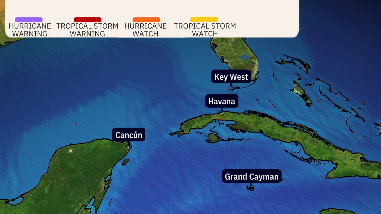
A Storm Surge Warning is in effect for...
* Florida west coast from Flamingo northward to Yankeetown,
including Charlotte Harbor and Tampa Bay
* Sebastian Inlet Florida to Altamaha Sound Georgia, including the
St. Johns River
A Hurricane Warning is in effect for...
* Florida west coast from Bonita Beach northward to Suwannee River,
including Tampa Bay
* Florida east coast from the St. Lucie/Martin County Line northward
to Ponte Vedra Beach
A Storm Surge Watch is in effect for...
* North of Altamaha Sound Georgia to Edisto Beach South Carolina
A Hurricane Watch is in effect for...
* Dry Tortugas
* Lake Okeechobee
* Florida west coast from Chokoloskee to south of Bonita Beach
* Florida east coast north of Ponte Vedra Beach to the mouth of the
St. Marys River
* Florida east coast from the St. Lucie/Martin County Line to the
Palm Beach/Martin County Line
A Tropical Storm Warning is in effect for...
* Florida Keys, including Dry Tortugas and Florida Bay
* Lake Okeechobee
* Florida west coast from Flamingo to south of Bonita Beach
* Florida west coast from north of Suwanee River to Indian Pass
* Florida east coast south of the St. Lucie/Martin County Line to
Flamingo
* North of Ponte Vedra Beach Florida to the Savannah River
* Extreme northwestern Bahamas, including Grand Bahama Island, the
Abacos, and Bimini
A Tropical Storm Watch is in effect for...
* North of the Savannah River to South Santee River South
Carolina
A Storm Surge Warning means there is a danger of life-threatening
inundation, from rising water moving inland from the coastline,
during the next 36 hours in the indicated locations. For a
depiction of areas at risk, please see the National Weather
Service Storm Surge Watch/Warning Graphic, available at
hurricanes.gov. This is a life-threatening situation. Persons
located within these areas should take all necessary actions to
protect life and property from rising water and the potential for
other dangerous conditions. Promptly follow evacuation and other
instructions from local officials.
A Hurricane Warning means that hurricane conditions are expected
somewhere within the warning area. A warning is typically issued
36 hours before the anticipated first occurrence of
tropical-storm-force winds, conditions that make outside
preparations difficult or dangerous. Preparations to protect life
and property should be rushed to completion.
A Tropical Storm Warning means that tropical storm conditions are
expected somewhere within the warning area within 36 hours.
A Storm Surge Watch means there is a possibility of life-
threatening inundation, from rising water moving inland from the
coastline, in the indicated locations during the next 48 hours.
For a depiction of areas at risk, please see the National Weather
Service Storm Surge Watch/Warning Graphic, available at
hurricanes.gov.
A Hurricane Watch means that hurricane conditions are possible
within the watch area. A watch is typically issued 48 hours
before the anticipated first occurrence of tropical-storm-force
winds, conditions that make outside preparations difficult or
dangerous.
A Tropical Storm Watch means that tropical storm conditions are
possible within the watch area, generally within 48 hours.
For storm information specific to your area in the United
States, including possible inland watches and warnings, please
monitor products issued by your local National Weather Service
forecast office. For storm information specific to your area
outside of the United States, please monitor products issued by
your national meteorological service.
DISCUSSION AND OUTLOOK
----------------------
At 800 AM EDT (1200 UTC), the eye of Hurricane Milton was located
near latitude 25.0 North, longitude 84.8 West. Milton is moving
toward the northeast near 16 mph (26 km/h). A northeastward motion
is expected through tonight. A turn toward the east-northeast and
east is expected on Thursday and Friday. On the forecast track, the
center of Milton will move across the eastern Gulf of Mexico today,
make landfall along the west-central coast of Florida late tonight
or early Thursday morning, and move off the east coast of Florida
over the western Atlantic Ocean Thursday afternoon.
Maximum sustained winds are near 155 mph (250 km/h) with higher
gusts. Milton is a category 4 hurricane on the Saffir-Simpson
Hurricane Wind Scale. Milton is expected to remain an extremely
dangerous major hurricane when it reaches the west-central coast of
Florida tonight.
Hurricane-force winds extend outward up to 30 miles (45 km) from
the center and tropical-storm-force winds extend outward up to 125
miles (205 km).
The minimum central pressure based on NOAA and Air Force Reserve
Hurricane Hunter data is 915 mb (27.02 inches).
HAZARDS AFFECTING LAND
----------------------
Key Messages for Milton can be found in the Tropical Cyclone
Discussion under AWIPS header MIATCDAT4 and WMO header WTNT44 KNHC
and on the web at hurricanes.gov/text/MIATCDAT4.shtml
STORM SURGE: The combination of a dangerous storm surge and the
tide will cause normally dry areas near the coast to be flooded by
rising waters moving inland from the shoreline. The water could
reach the following heights above ground somewhere in the indicated
areas if the peak surge occurs at the time of high tide...
Anna Maria Island, FL to Boca Grande, FL...10-15 ft
Anclote River, FL to Anna Maria Island, FL...8-12 ft
Tampa Bay...8-12 ft
Boca Grande, FL to Bonita Beach, FL...8-12 ft
Charlotte Harbor...8-12 ft
Bonita Beach, FL to Chokoloskee, FL...5-8 ft
Aripeka, FL to Anclote River, FL...4-7 ft
Chokoloskee, FL to Flamingo, FL...3-5 ft
Sebastian Inlet, FL to Altamaha Sound, GA...3-5 ft
Altamaha Sound, GA to Edisto Beach, SC...2-4 ft
Yankeetown, FL to Aripeka, FL...2-4 ft
Dry Tortugas...2-4 ft
St. Johns River...2-4 ft
The deepest water will occur along the immediate coast near and to
the south of the landfall location, where the surge will be
accompanied by large and dangerous waves. Surge-related flooding
depends on the relative timing of the surge and the tidal cycle,
and can vary greatly over short distances. For information
specific to your area, please see products issued by your local
National Weather Service forecast office.
For a complete depiction of areas at risk of storm surge
inundation, please see the National Weather Service Peak Storm
Surge Graphic, available at
hurricanes.gov/graphics_at4.shtml?peakSurge.
RAINFALL: Rainfall amounts of 6 to 12 inches, with localized totals
up to 18 inches, are expected across central to northern portions of
the Florida Peninsula through Thursday. This rainfall brings the
risk of catastrophic and life-threatening flash and urban flooding,
along with moderate to major river flooding.
For a complete depiction of forecast rainfall associated with
Hurricane Milton, please see the National Weather Service Storm
Total Rainfall Graphic, available at
hurricanes.gov/graphics_at4.shtml?rainqpf and the Flash Flood Risk
graphic at hurricanes.gov/graphics_at4.shtml?ero.
WIND: Hurricane conditions are expected in the hurricane warning
area across Florida beginning this evening through early Thursday
and are possible in the hurricane watch area on Thursday. Tropical
storm conditions are expected to begin in the warning area on the
west coast of Florida around midday, spreading across the peninsula
and reaching the east coast tonight. Tropical storm conditions are
expected to begin in the warning area on the east coast of Florida
tonight and along the Georgia coast on Thursday.
Tropical storm conditions are expected in portions of the
northwestern Bahamas on Thursday.
Tropical storm conditions are possible within the watch area
on the South Carolina coast on Thursday.
TORNADOES: Several tornadoes are likely today and tonight across
parts of central and southern Florida.
SURF: Swells generated by Milton are expected to continue to affect
much of the Gulf Coast and will increase along the southeastern U.S.
coast during the next day or two. These swells are likely to cause
life-threatening surf and rip current conditions. Please consult
products from your local weather office.
NEXT ADVISORY
-------------
Next complete advisory at 1100 AM EDT.
Hourly Tropical Cyclone Updates will begin at 900 AM EDT (1300 UTC).
$$
Forecaster Berg
- Wed, 09 Oct 2024 08:57:04 +0000: Atlantic Hurricane MILTON Forecast/Advisory Number... - Atlantic Hurricane MILTON Forecast/Advisory Number 17 NWS NATIONAL HURRICANE CENTER MIAMI FL AL142024 0900 UTC WED OCT 09 2024 HURRICANE CENTER LOCATED NEAR 24.5N 85.4W AT 09/0900Z POSITION ACCURATE WITHIN 10 NM PRESENT MOVEMENT TOWARD THE NORTHEAST OR 45 DEGREES AT 12 KT ESTIMATED MINIMUM CENTRAL PRESSURE 907 MB EYE DIAMETER 10 NM MAX SUSTAINED WINDS 140 KT WITH GUSTS TO 170 KT. 64 KT....... 25NE 25SE 25SW 25NW. 50 KT....... 45NE 50SE 50SW 50NW. 34 KT.......100NE 100SE 100SW 110NW. 12 FT SEAS..150NE 150SE 360SW 360NW. WINDS AND SEAS VARY GREATLY IN EACH QUADRANT. RADII IN NAUTICAL MILES ARE THE LARGEST RADII EXPECTED ANYWHERE IN THAT QUADRANT. REPEAT...CENTER LOCATED NEAR 24.5N 85.4W AT 09/0900Z AT 09/0600Z CENTER WAS LOCATED NEAR 23.8N 85.9W FORECAST VALID 09/1800Z 25.9N 84.3W MAX WIND 130 KT...GUSTS 160 KT. 64 KT... 30NE 30SE 30SW 30NW. 50 KT... 50NE 50SE 50SW 50NW. 34 KT...130NE 120SE 100SW 130NW. FORECAST VALID 10/0600Z 27.4N 82.6W...INLAND MAX WIND 115 KT...GUSTS 140 KT. 64 KT... 35NE 35SE 35SW 40NW. 50 KT... 70NE 60SE 60SW 70NW. 34 KT...180NE 140SE 100SW 150NW. FORECAST VALID 10/1800Z 28.2N 80.5W...OVER WATER MAX WIND 70 KT...GUSTS 85 KT. 64 KT... 30NE 30SE 0SW 20NW. 50 KT... 90NE 60SE 50SW 90NW. 34 KT...240NE 150SE 130SW 180NW. FORECAST VALID 11/0600Z 28.8N 76.8W MAX WIND 60 KT...GUSTS 75 KT. 50 KT... 80NE 60SE 50SW 80NW. 34 KT...240NE 150SE 120SW 190NW. FORECAST VALID 11/1800Z 29.1N 73.0W...Post-TROP/EXTRATROP MAX WIND 55 KT...GUSTS 65 KT. 50 KT... 70NE 50SE 40SW 70NW. 34 KT...240NE 150SE 150SW 180NW. FORECAST VALID 12/0600Z 29.7N 69.2W...POST-TROP/EXTRATROP MAX WIND 50 KT...GUSTS 60 KT. 50 KT... 60NE 60SE 0SW 60NW. 34 KT...150NE 120SE 120SW 150NW. EXTENDED OUTLOOK. NOTE...ERRORS FOR TRACK HAVE AVERAGED NEAR 125 NM ON DAY 4 AND 175 NM ON DAY 5...AND FOR INTENSITY NEAR 15 KT EACH DAY OUTLOOK VALID 13/0600Z 31.3N 62.0W...POST-TROP/EXTRATROP MAX WIND 40 KT...GUSTS 50 KT. 34 KT...120NE 90SE 90SW 120NW. OUTLOOK VALID 14/0600Z 32.1N 56.0W...POST-TROP/EXTRATROP MAX WIND 35 KT...GUSTS 45 KT. 34 KT...120NE 90SE 90SW 120NW. REQUEST FOR 3 HOURLY SHIP REPORTS WITHIN 300 MILES OF 24.5N 85.4W Intermediate PUBLIC Advisory...WTNT34 KNHC/MIATCPAT4...AT 09/1200Z NEXT ADVISORY AT 09/1500Z $$ FORECASTER CANGIALOSI
000
WTNT24 KNHC 090854
TCMAT4
HURRICANE MILTON FORECAST/ADVISORY NUMBER 17
NWS NATIONAL HURRICANE CENTER MIAMI FL AL142024
0900 UTC WED OCT 09 2024
HURRICANE CENTER LOCATED NEAR 24.5N 85.4W AT 09/0900Z
POSITION ACCURATE WITHIN 10 NM
PRESENT MOVEMENT TOWARD THE NORTHEAST OR 45 DEGREES AT 12 KT
ESTIMATED MINIMUM CENTRAL PRESSURE 907 MB
EYE DIAMETER 10 NM
MAX SUSTAINED WINDS 140 KT WITH GUSTS TO 170 KT.
64 KT....... 25NE 25SE 25SW 25NW.
50 KT....... 45NE 50SE 50SW 50NW.
34 KT.......100NE 100SE 100SW 110NW.
12 FT SEAS..150NE 150SE 360SW 360NW.
WINDS AND SEAS VARY GREATLY IN EACH QUADRANT. RADII IN NAUTICAL
MILES ARE THE LARGEST RADII EXPECTED ANYWHERE IN THAT QUADRANT.
REPEAT...CENTER LOCATED NEAR 24.5N 85.4W AT 09/0900Z
AT 09/0600Z CENTER WAS LOCATED NEAR 23.8N 85.9W
FORECAST VALID 09/1800Z 25.9N 84.3W
MAX WIND 130 KT...GUSTS 160 KT.
64 KT... 30NE 30SE 30SW 30NW.
50 KT... 50NE 50SE 50SW 50NW.
34 KT...130NE 120SE 100SW 130NW.
FORECAST VALID 10/0600Z 27.4N 82.6W...INLAND
MAX WIND 115 KT...GUSTS 140 KT.
64 KT... 35NE 35SE 35SW 40NW.
50 KT... 70NE 60SE 60SW 70NW.
34 KT...180NE 140SE 100SW 150NW.
FORECAST VALID 10/1800Z 28.2N 80.5W...OVER WATER
MAX WIND 70 KT...GUSTS 85 KT.
64 KT... 30NE 30SE 0SW 20NW.
50 KT... 90NE 60SE 50SW 90NW.
34 KT...240NE 150SE 130SW 180NW.
FORECAST VALID 11/0600Z 28.8N 76.8W
MAX WIND 60 KT...GUSTS 75 KT.
50 KT... 80NE 60SE 50SW 80NW.
34 KT...240NE 150SE 120SW 190NW.
FORECAST VALID 11/1800Z 29.1N 73.0W...POST-TROP/EXTRATROP
MAX WIND 55 KT...GUSTS 65 KT.
50 KT... 70NE 50SE 40SW 70NW.
34 KT...240NE 150SE 150SW 180NW.
FORECAST VALID 12/0600Z 29.7N 69.2W...POST-TROP/EXTRATROP
MAX WIND 50 KT...GUSTS 60 KT.
50 KT... 60NE 60SE 0SW 60NW.
34 KT...150NE 120SE 120SW 150NW.
EXTENDED OUTLOOK. NOTE...ERRORS FOR TRACK HAVE AVERAGED NEAR 125 NM
ON DAY 4 AND 175 NM ON DAY 5...AND FOR INTENSITY NEAR 15 KT EACH DAY
OUTLOOK VALID 13/0600Z 31.3N 62.0W...POST-TROP/EXTRATROP
MAX WIND 40 KT...GUSTS 50 KT.
34 KT...120NE 90SE 90SW 120NW.
OUTLOOK VALID 14/0600Z 32.1N 56.0W...POST-TROP/EXTRATROP
MAX WIND 35 KT...GUSTS 45 KT.
34 KT...120NE 90SE 90SW 120NW.
REQUEST FOR 3 HOURLY SHIP REPORTS WITHIN 300 MILES OF 24.5N 85.4W
INTERMEDIATE PUBLIC ADVISORY...WTNT34 KNHC/MIATCPAT4...AT 09/1200Z
NEXT ADVISORY AT 09/1500Z
$$
FORECASTER CANGIALOSI
- Wed, 09 Oct 2024 08:57:04 +0000: Atlantic Hurricane Milton Discussion Number 17 - Atlantic Hurricane Milton Discussion Number 17
000
WTNT44 KNHC 090855
TCDAT4
Hurricane Milton Discussion Number 17
NWS National Hurricane Center Miami FL AL142024
400 AM CDT Wed Oct 09 2024
Milton has been maintaining its strength as a catastrophic category
5 hurricane over the southeastern Gulf of Mexico. Satellite and
Doppler radar images indicate that the major hurricane has a
compact, symmetric, and very powerful inner core. Based on
aircraft data, the minimum pressure has dropped to 907 mb and the
maximum sustained winds remain near 140 kt. The wind field of
Milton is gradually expanding, and the wind radii have been adjusted
based on a combination of the Hurricane Hunter data and ASCAT
passes. There is an area of heavy rain beginning to spread across
portions of southwestern and west-central Florida out ahead of
Milton, and weather conditions will steadily deteriorate across
portions of the Florida Gulf Coast throughout the day.
Milton is moving northeastward at 12 kt in the flow between a mid-
to upper-level trough over the northern Gulf and a ridge located
over the Greater Antilles. This motion should generally continue
until Milton makes landfall in Florida, which is likely to occur
late tonight or early Thursday morning. After the hurricane reaches
the coast, a turn to the east-northeast is expected as another
trough approaches the system from the west. Milton should exit
Florida and move over the Atlantic waters Thursday afternoon and
accelerate eastward after that. The NHC track forecast is nudged a
little to the north of the previous one to be in better agreement
with the latest models. It should be noted that this forecast is
based on the model fields, not the interpolated models which
appear to be too far south. Users are urged not to focus on the
exact landfall point as the average error at 24 hours is about 40
miles.
The global models agree that vertical wind shear is expected begin
to increase over Milton later today, and that should cause some
weakening. However, there is high confidence that Milton will
remain a very dangerous hurricane when it reaches Florida, and
maintain hurricane status as it moves across the state. The
cyclone is expected to become extratropical over the Atlantic on
Friday and gradually weaken. The NHC intensity forecast is similar
to the previous one and near the high end of the model guidance.
Milton's wind field is expected to grow considerably in size while
it moves across Florida. Additionally, a large region of tropical
storm and hurricane-force winds could occur on the northwest/back
side of the storm since Milton will be interacting with a frontal
boundary and beginning extratropical transition. Damaging winds,
life-threatening storm surge, and heavy rainfall will extend well
outside the forecast cone. This is a very serious situation and
residents in Florida should closely follow orders from their local
emergency management officials. Evacuations and other preparations
should be rushed to completion. Milton has the potential to be one
of the most destructive hurricanes on record for west-central
Florida.
Key Messages:
1. A large area of destructive storm surge, with highest inundations
of 10 ft or greater, is expected along a portion of the west-central
coast of the Florida Peninsula. If you are in the Storm Surge
Warning area, this is an extremely life-threatening situation, and
you should evacuate as soon as possible if ordered by local
officials.
2. Devastating hurricane-force winds are expected along portions of
the west coast of Florida, where a Hurricane Warning is in effect.
Milton is forecast to remain a hurricane while it crosses the
Florida Peninsula and life-threatening hurricane-force winds,
especially in gusts, are expected to spread inland across the
peninsula. Preparations to protect life and property, including
being ready for long-duration power outages, should be rushed to
completion.
3. Heavy rainfall across the Florida Peninsula through Thursday
brings the risk of catastrophic and life-threatening flash and urban
flooding along with moderate to major river flooding, especially in
areas where coastal and inland flooding combine to increase the
overall flood threat.
FORECAST POSITIONS AND MAX WINDS
INIT 09/0900Z 24.5N 85.4W 140 KT 160 MPH
12H 09/1800Z 25.9N 84.3W 130 KT 150 MPH
24H 10/0600Z 27.4N 82.6W 115 KT 130 MPH...NEAR THE COAST
36H 10/1800Z 28.2N 80.5W 70 KT 80 MPH...OVER WATER
48H 11/0600Z 28.8N 76.8W 60 KT 70 MPH
60H 11/1800Z 29.1N 73.0W 55 KT 65 MPH...POST-TROP/EXTRATROP
72H 12/0600Z 29.7N 69.2W 50 KT 60 MPH...POST-TROP/EXTRATROP
96H 13/0600Z 31.3N 62.0W 40 KT 45 MPH...POST-TROP/EXTRATROP
120H 14/0600Z 32.1N 56.0W 35 KT 40 MPH...POST-TROP/EXTRATROP
$$
Forecaster Cangialosi/Bucci/Roberts